MyTopo
Houston Missouri US Topo Map
Couldn't load pickup availability
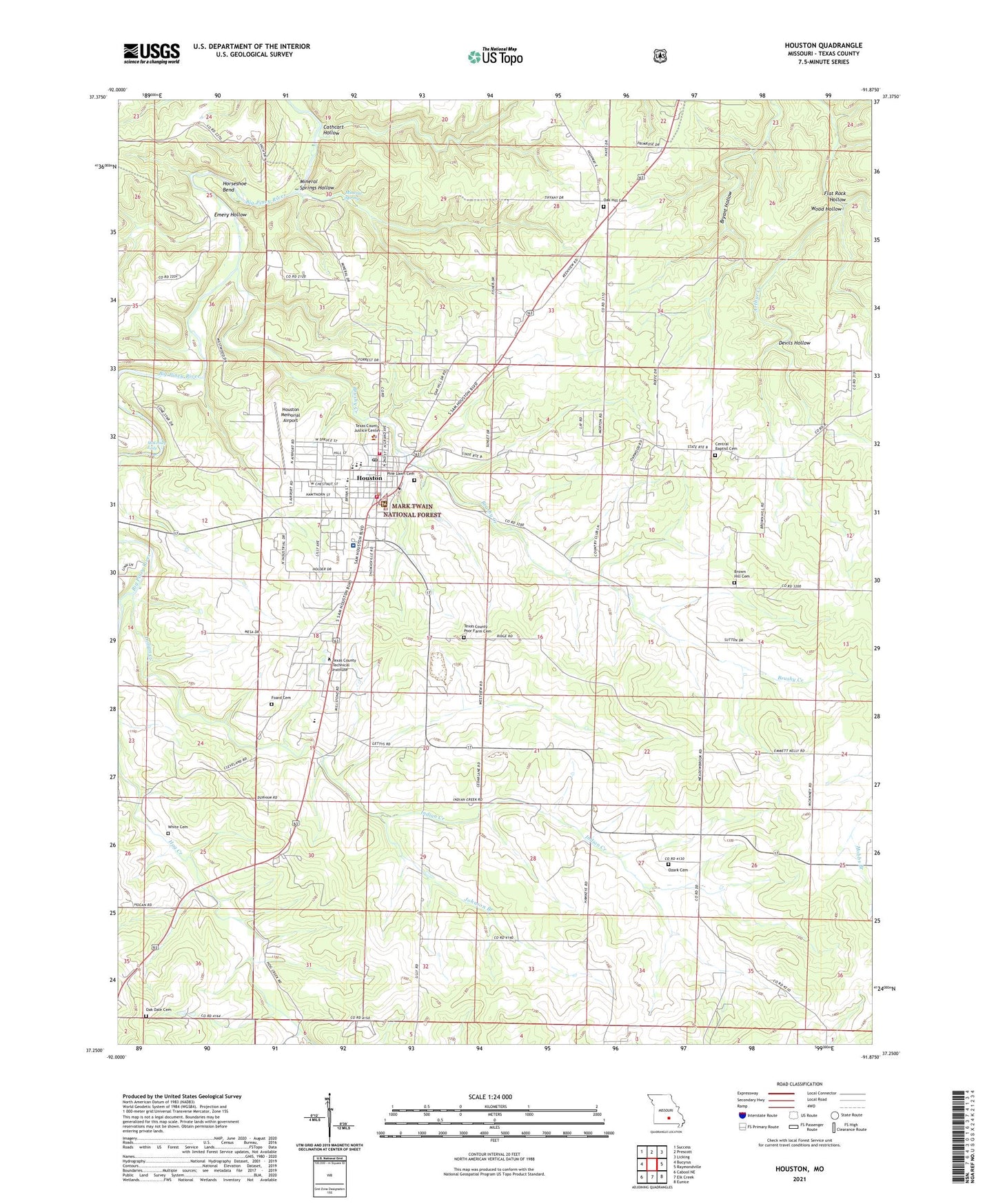
2021 topographic map quadrangle Houston in the state of Missouri. Scale: 1:24000. Based on the newly updated USGS 7.5' US Topo map series, this map is in the following counties: Texas. The map contains contour data, water features, and other items you are used to seeing on USGS maps, but also has updated roads and other features. This is the next generation of topographic maps. Printed on high-quality waterproof paper with UV fade-resistant inks.
Quads adjacent to this one:
West: Bucyrus
Northwest: Success
North: Prescott
Northeast: Licking
East: Raymondville
Southeast: Eunice
South: Elk Creek
Southwest: Cabool NE
Contains the following named places: Brown Hill School, Brushy Creek, Cathcart Hollow, Central Church, City of Houston, Cleveland Church, Cleveland School, Devils Hollow, Emery Hollow, Flat Rock Hollow, Foard Cemetery, Horseshoe Bend, Houston, Houston Fire Department, Houston Memorial Airport, Houston Police Department, Houston Post Office, Houston Rural Fire Protection Association, Hutcheson Lake, Hutcheson Lake Dam, Indian Creek, Johnson Branch, KBTC-AM (Houston), KUNQ-FM (Houston), Mark Twain National Forest Houston - Rolla - Cedar Creek Ranger District Houston Office, McKinney Eddy, Mineral Spring, Mineral Springs City, Mineral Springs Ford, Mineral Springs Hollow, Missouri Department of Conservation Forestry Ozark Regional Field Fire Office Houston, Oak Hill School, Oakdale Church, Ozark Church, Ozark School, Pine Lawn Cemetery, Samoa, Sunset Drive-In, Texas County, Texas County Memorial Hospital, Texas County Memorial Hospital Heliport, Texas County Poor Farm Cemetery, Texas County Sheriff's Office, Township of Piney, White Cemetery, Wood Hollow, ZIP Code: 65483