MyTopo
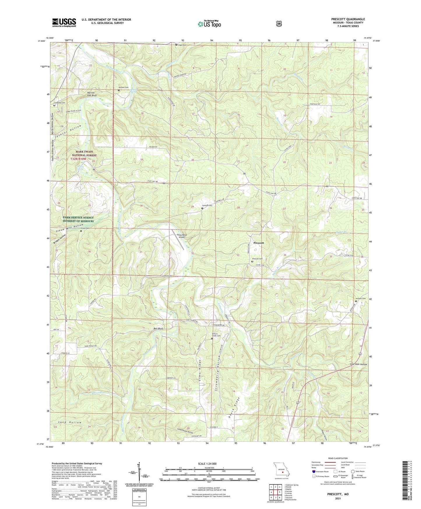
Prescott Missouri US Topo Map
Couldn't load pickup availability
Also explore the Prescott Forest Service Topo of this same quad for updated USFS data
2021 topographic map quadrangle Prescott in the state of Missouri. Scale: 1:24000. Based on the newly updated USGS 7.5' US Topo map series, this map is in the following counties: Texas. The map contains contour data, water features, and other items you are used to seeing on USGS maps, but also has updated roads and other features. This is the next generation of topographic maps. Printed on high-quality waterproof paper with UV fade-resistant inks.
Quads adjacent to this one:
West: Success
Northwest: Slabtown Spring
North: Beulah
Northeast: Maples
East: Licking
Southeast: Raymondville
South: Houston
Southwest: Bucyrus
This map covers the same area as the classic USGS quad with code o37091d8.
Contains the following named places: Antioch Cemetery, Arthur Creek, Arthur Creek School, Bell Bluff, Bender Creek, Boiling Spring, Boone Creek, Bridges Hollow, Brushy Creek, Bryant Hollow, Burnett Cemetery, Burnett Spring, Burton Branch, Cantrell Church, Cantrell School, Cavaness Cemetery, Crane Cemetery, Dzurk Ridge, Elmo Ridge, Jacktar Hollow, Mullin Branch, Narrow Gap Bluff, North Jacktar Hollow, Phillips Creek, Pine Grove School, Pine Ridge School, Piney Bend Airport, Prescott, Prescott Church, Raftville, Sand Hollow, Sandy Shoals Ford, Schoolhouse Hollow, Sliger Cemetery, South Jacktar Hollow, Steam Mill Hollow, Strawberry Hollow, Taus River Ranch Airport, Township of Lynch, Venable, Venable School, Whitlock School, ZIP Code: 65542