MyTopo
Hughesville Missouri US Topo Map
Couldn't load pickup availability
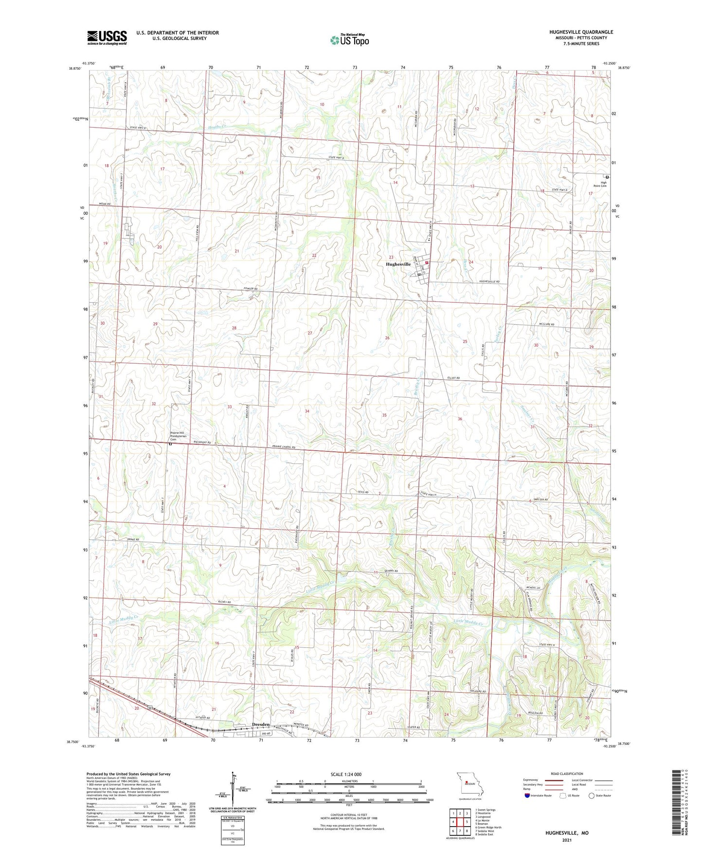
2021 topographic map quadrangle Hughesville in the state of Missouri. Scale: 1:24000. Based on the newly updated USGS 7.5' US Topo map series, this map is in the following counties: Pettis. The map contains contour data, water features, and other items you are used to seeing on USGS maps, but also has updated roads and other features. This is the next generation of topographic maps. Printed on high-quality waterproof paper with UV fade-resistant inks.
Quads adjacent to this one:
West: La Monte
Northwest: Sweet Springs
North: Houstonia
Northeast: Longwood
East: Beaman
Southeast: Sedalia East
South: Sedalia West
Southwest: Green Ridge North
Contains the following named places: Bethel Church, Brushy Creek, Craft, Dresden, High Point Cemetery, Hughesville, Hughesville Community Fire Department, Hughesville Post Office, Hughesville School, Little Muddy Creek, Northwest High School, Prairie Hill Church, Prairie Hill Presbyterian Cemetery, Prairie Hill School, Smelser School, Township of Dresden, Township of Hughesville, Village of Hughesville, Walnut Grove School