MyTopo
La Monte Missouri US Topo Map
Couldn't load pickup availability
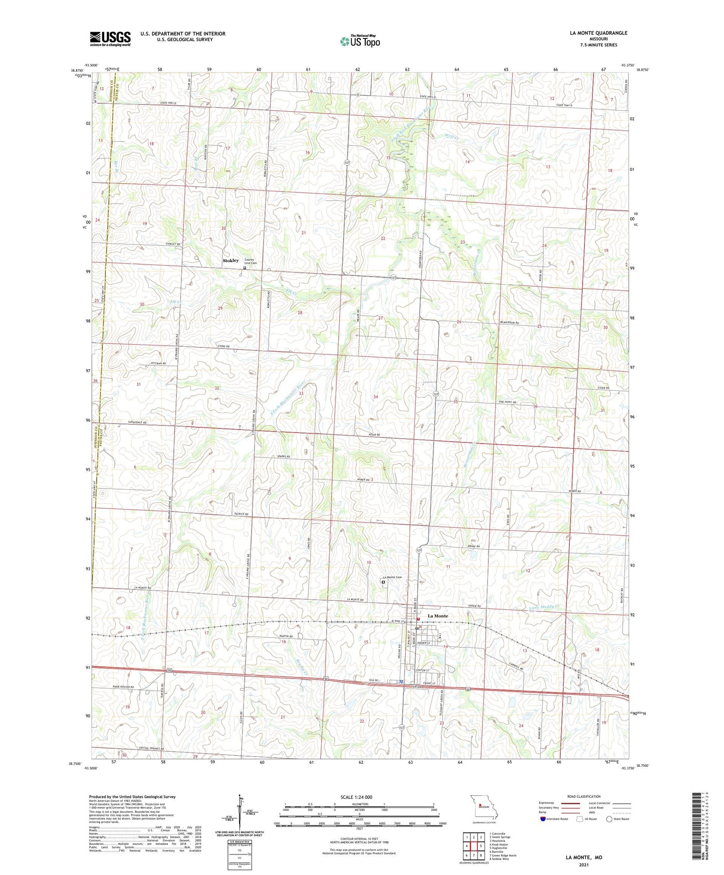
2021 topographic map quadrangle La Monte in the state of Missouri. Scale: 1:24000. Based on the newly updated USGS 7.5' US Topo map series, this map is in the following counties: Pettis, Johnson. The map contains contour data, water features, and other items you are used to seeing on USGS maps, but also has updated roads and other features. This is the next generation of topographic maps. Printed on high-quality waterproof paper with UV fade-resistant inks.
Quads adjacent to this one:
West: Knob Noster
Northwest: Concordia
North: Sweet Springs
Northeast: Houstonia
East: Hughesville
Southeast: Sedalia West
South: Green Ridge North
Southwest: Burtville
This map covers the same area as the classic USGS quad with code o38093g4.
Contains the following named places: Beaverdam Creek, Bleak Mound School, City of La Monte, County Line Church, East Prairie Grove School, Eden Valley School, Elk Creek, Higgins School, La Monte, La Monte Cemetery, La Monte Community Volunteer Fire Department, La Monte Elementary School, La Monte High School, La Monte Police Department, La Monte Post Office, Oak Point School, Rowletta, Smith Lake Dam, Stokley, Sunny Dell School, Township of Blackwater, Township of La Monte, West Prairie Grove School, Wolf Creek, ZIP Code: 65337