MyTopo
Beaman Missouri US Topo Map
Couldn't load pickup availability
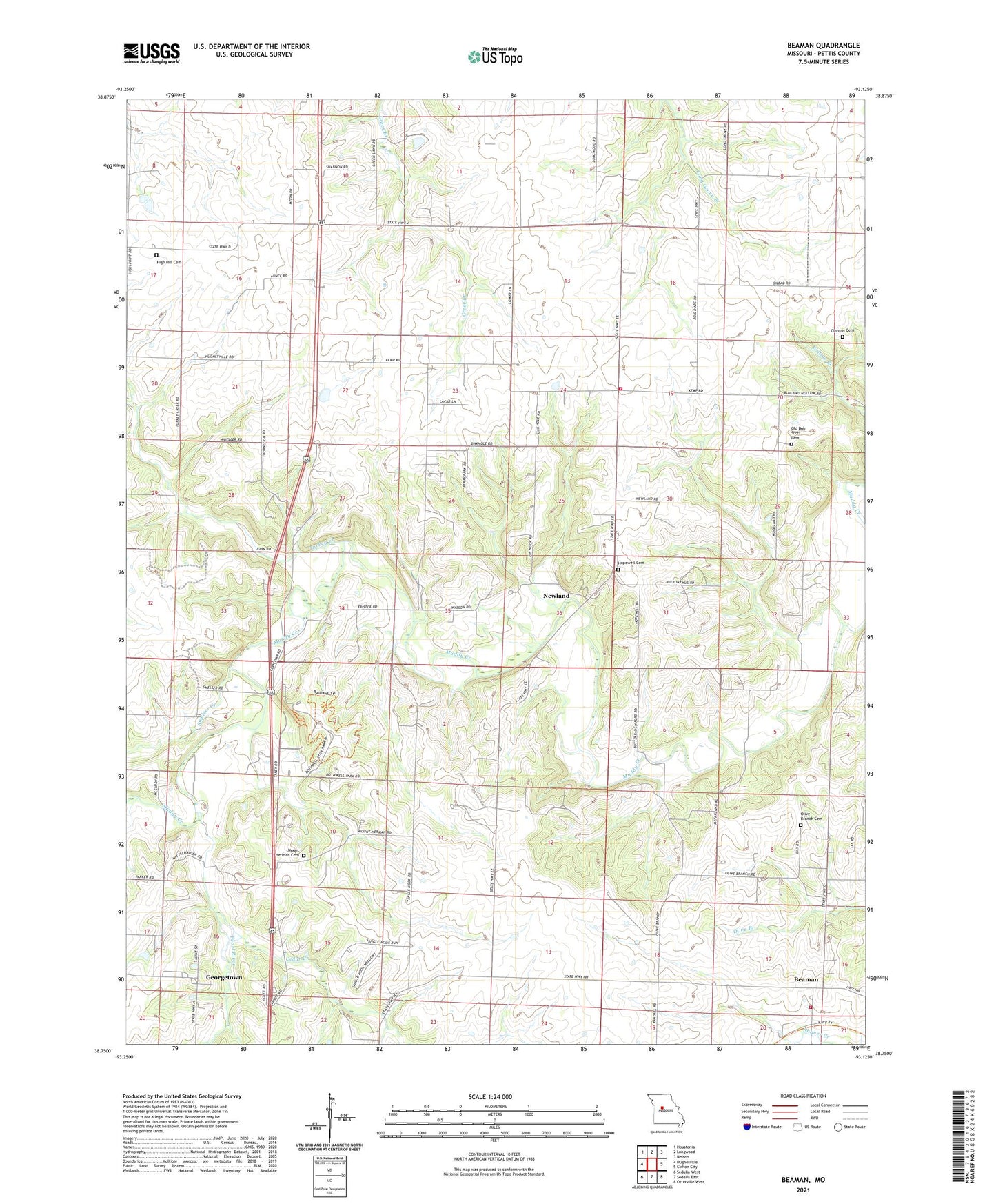
2021 topographic map quadrangle Beaman in the state of Missouri. Scale: 1:24000. Based on the newly updated USGS 7.5' US Topo map series, this map is in the following counties: Pettis. The map contains contour data, water features, and other items you are used to seeing on USGS maps, but also has updated roads and other features. This is the next generation of topographic maps. Printed on high-quality waterproof paper with UV fade-resistant inks.
Quads adjacent to this one:
West: Hughesville
Northwest: Houstonia
North: Longwood
Northeast: Nelson
East: Clifton City
Southeast: Otterville West
South: Sedalia East
Southwest: Sedalia West
This map covers the same area as the classic USGS quad with code o38093g2.
Contains the following named places: Beaman, Bothwell School, Cartwright School, Cedar Creek, Clopton Cemetery, Fire District 1 Station 4 Pettit County, Fristoe School, Georgetown, High Hill Cemetery, Hopewell Cemetery, Hopewell Church, Hopewell School, Mount Herman Church, Newland, Old Bob Scott Cemetery, Olive Branch Cemetery, Olive Branch Church, Olive Branch School, Pearl River, Pettis County Fire District 1 Station 6, Smelser Creek, Sunnymede School, Tanglenook School, Thornleigh, Township of Cedar, Turkey Creek, Woodland School, ZIP Code: 65334