MyTopo
Indian Grove Missouri US Topo Map
Couldn't load pickup availability
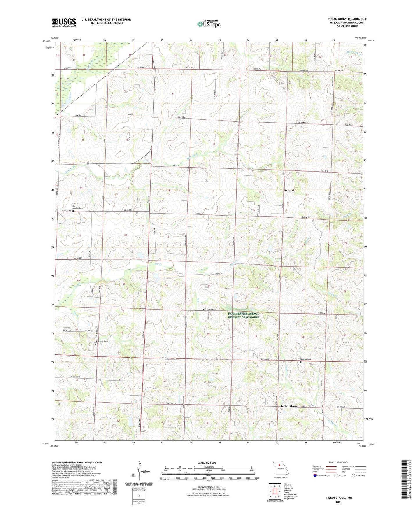
2021 topographic map quadrangle Indian Grove in the state of Missouri. Scale: 1:24000. Based on the newly updated USGS 7.5' US Topo map series, this map is in the following counties: Chariton. The map contains contour data, water features, and other items you are used to seeing on USGS maps, but also has updated roads and other features. This is the next generation of topographic maps. Printed on high-quality waterproof paper with UV fade-resistant inks.
Quads adjacent to this one:
West: Mendon
Northwest: Sumner
North: Rothville
Northeast: Marceline
East: Mike
Southeast: Keytesville
South: Brunswick East
Southwest: Brunswick West
Contains the following named places: 158 Dam, 64660, Elm Branch, German Cemetery, Huessner Lake, Huessner Lake Dam, Indian Grove, Indian Grove School, Newcomer, Newcomer Cemetery, Newcomer School, Newhall, North Newhall School, Old Mendon Cemetery, Powell Church, Saint Raphael Church, Siloam Church, South Branch, South Newhall School, Township of Salt Creek, West School, Woods School, Zion Church, Zion School