MyTopo
Sumner Missouri US Topo Map
Couldn't load pickup availability
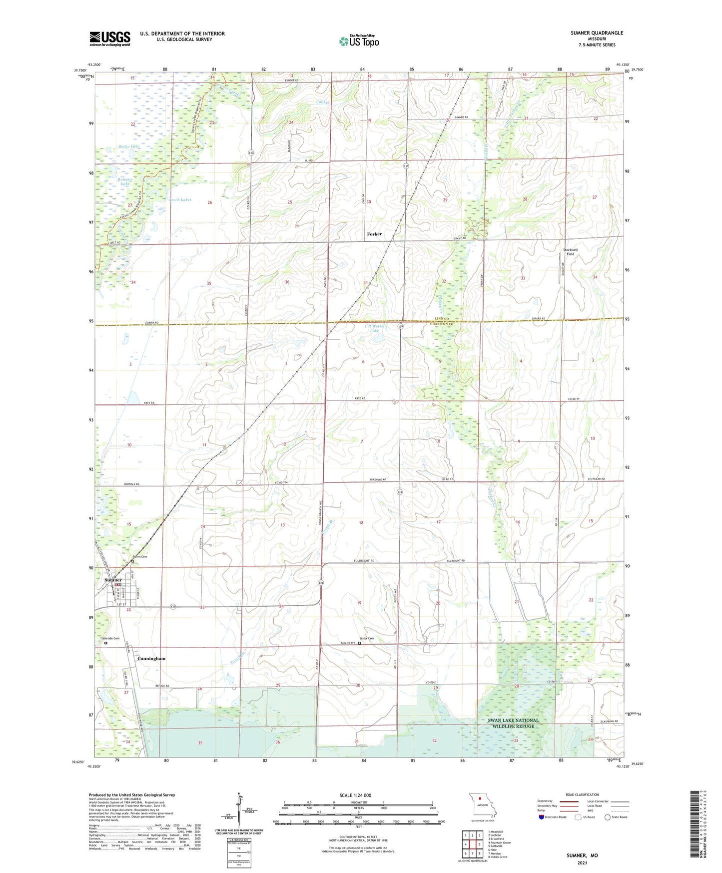
2021 topographic map quadrangle Sumner in the state of Missouri. Scale: 1:24000. Based on the newly updated USGS 7.5' US Topo map series, this map is in the following counties: Chariton, Linn. The map contains contour data, water features, and other items you are used to seeing on USGS maps, but also has updated roads and other features. This is the next generation of topographic maps. Printed on high-quality waterproof paper with UV fade-resistant inks.
Quads adjacent to this one:
West: Fountain Grove
Northwest: Meadville
North: Laclede
Northeast: Brookfield
East: Rothville
Southeast: Indian Grove
South: Mendon
Southwest: Hale
This map covers the same area as the classic USGS quad with code o39093f2.
Contains the following named places: Boiler Lake, C R Wetzel Lake, C R Wetzel Lake Dam, Coal Creek, Cunningham, Forker, Forker Boomer Post Office, Forker School, Harlow Fay Lakes, Kaye School, Lakeside Cemetery, Lewis Lakes, Little Turkey Creek, Pleasant Grove School, Prairie Mound School, Purvis Cemetery, Ransom Lake, Stockwell Field, Sumner, Sumner Community Fire Department, Sumner Post Office, Swan Lake National Wildlife Refuge Habitat Trail, Taylor Cemetery, Taylor School, Tough Branch, Town of Sumner, Township of Cunningham, Turkey Creek, Valley Farm Feedlot, ZIP Code: 64681