MyTopo
Leslie Missouri US Topo Map
Couldn't load pickup availability
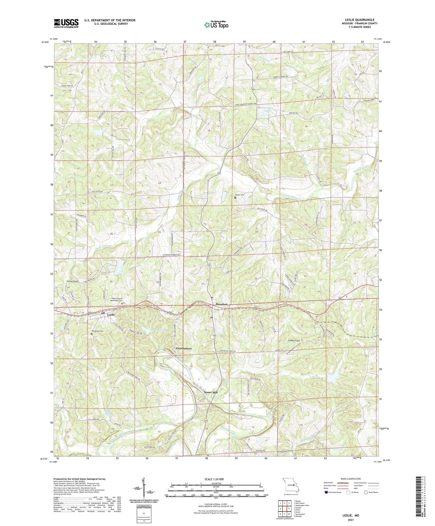
2021 topographic map quadrangle Leslie in the state of Missouri. Scale: 1:24000. Based on the newly updated USGS 7.5' US Topo map series, this map is in the following counties: Franklin. The map contains contour data, water features, and other items you are used to seeing on USGS maps, but also has updated roads and other features. This is the next generation of topographic maps. Printed on high-quality waterproof paper with UV fade-resistant inks.
Quads adjacent to this one:
West: Gerald
Northwest: Dissen
North: New Haven
Northeast: Washington West
East: Union
Southeast: Stanton
South: Spring Bluff
Southwest: Strain
Contains the following named places: Adams School, Anglers Lake Dam, Beaufort, Beaufort - Leslie Fire Protection District Station 1, Beaufort - Leslie Fire Protection District Station 2, Beaufort Lookout Tower, Beaufort Post Office, Butler Cemetery, Casco, Casco Church, Clover Bottom Fish Farm Lake Dam, Crazy Fox Farm Lake Dam, Dierking Branch, Findley Field, Flamingo Lakes, Fox Creek, Greenstreet, Holy Family School, Janssen Lake Dam, Leslie, Leslie Post Office, Leslie United Methodist Cemetery, Liberty School, Little Creek, Little Creek Ford, Little Creek School, Little Creek Spring, Lucky Nugget Lake Dam, McGinnis Lake Dam, Mineral Lake, Mineral Lake Dam, Netties Greenhouse Lake Dam, Noser Mill, Old Beaufort School, Pleasant Hill School, Port Hudson Church, Port Hudson Holy Family Church, Port Hudson Lutheran School, Saint Johns Church, School Number 11, Sipe Lake Dam, South Beaufort School, Sunnys Field, Township of Lyon, Village of Leslie, Woodman Cemetery, Zion Church, ZIP Codes: 63013, 63056