MyTopo
Gerald Missouri US Topo Map
Couldn't load pickup availability
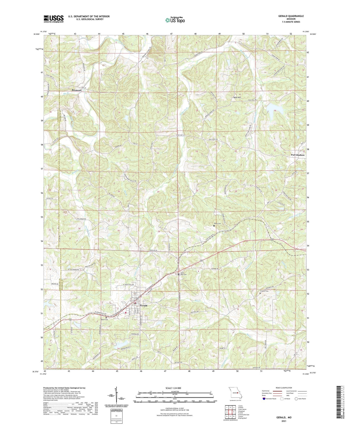
2021 topographic map quadrangle Gerald in the state of Missouri. Scale: 1:24000. Based on the newly updated USGS 7.5' US Topo map series, this map is in the following counties: Franklin, Gasconade. The map contains contour data, water features, and other items you are used to seeing on USGS maps, but also has updated roads and other features. This is the next generation of topographic maps. Printed on high-quality waterproof paper with UV fade-resistant inks.
Quads adjacent to this one:
West: Rosebud
Northwest: Swiss
North: Dissen
Northeast: New Haven
East: Leslie
Southeast: Spring Bluff
South: Strain
Southwest: Owensville East
This map covers the same area as the classic USGS quad with code o38091d3.
Contains the following named places: Antioch Church, Bald Hill, Barren Fork, Bates Cemetery, Beemont, Beemont School, Big Branch, Boeuf Cemetery, Buffalo Ridge School, City of Gerald, Forboro Lake Dam, Gerald, Gerald - Rosebud Fire Protection District Station 1, Gerald - Rosebud Fire Protection District Station 2, Gerald Police Department, Gerald Post Office, Gerald School, Good Hope School, Gregory Cemetery, Harry Panhorst Lake, Jaegers Shop, Kamper Lake Dam, Middle Fork, Number 364 Dam, Opossum Creek, Panhorst Lake Dam, Pin Oak Creek, Pinoak School, Port Hudson, Rocky Ridge School, Saint Paul Cemetery, Schnitzer Lake Dam, Skinner Creek, ZIP Code: 63037