MyTopo
Lewis Hollow Missouri US Topo Map
Couldn't load pickup availability
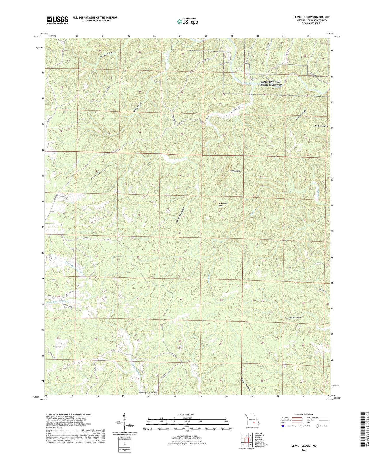
2021 topographic map quadrangle Lewis Hollow in the state of Missouri. Scale: 1:24000. Based on the newly updated USGS 7.5' US Topo map series, this map is in the following counties: Shannon. The map contains contour data, water features, and other items you are used to seeing on USGS maps, but also has updated roads and other features. This is the next generation of topographic maps. Printed on high-quality waterproof paper with UV fade-resistant inks.
Quads adjacent to this one:
West: Hartshorn
Northwest: Montauk
North: Cedargrove
Northeast: Gladden
East: Round Spring
Southeast: Alley Spring
South: Summersville NE
Southwest: Summersville
Contains the following named places: Black Valley School, Burr Oak Basin, Dooley Hollow, Fishtrap Hollow, Hartshorn Lookout Tower, Hartshorn State Forest, Hieronymus Hollow, Lewis Hollow, Lewis Hollow School, North Fork Black Valley Creek, Skunk Pond, Skunk Pond State Wildlife Management Area, South Fork Black Valley Creek, Standing Rock Hollow, Sumac Valley, Sunklands-Burr Oak State Wildlife Area, The Sunkland, Wagon Trace, Willow Springs School