MyTopo
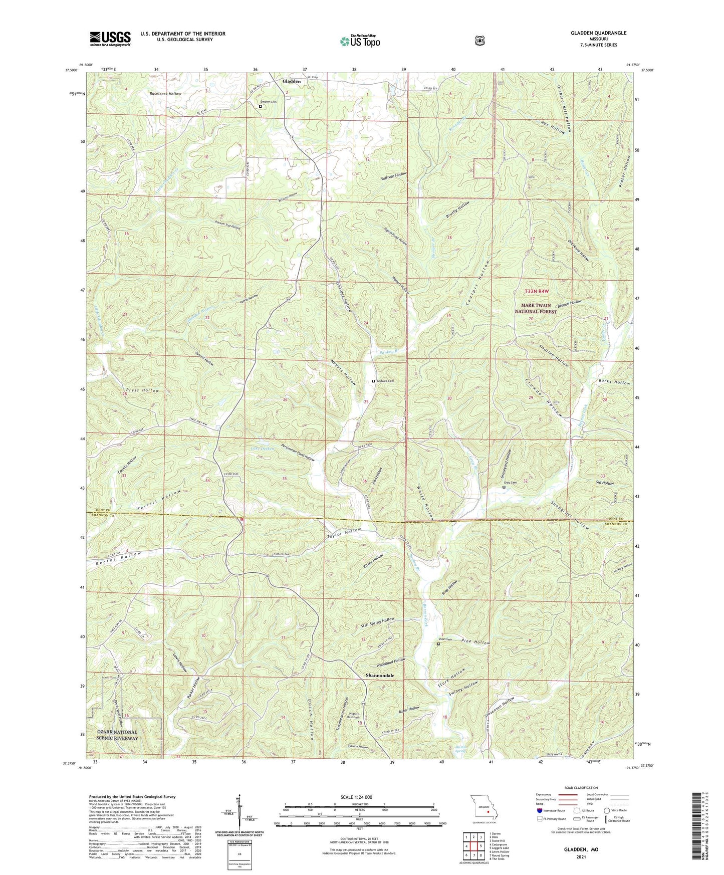
Gladden Missouri US Topo Map
Couldn't load pickup availability
Also explore the Gladden Forest Service Topo of this same quad for updated USFS data
2021 topographic map quadrangle Gladden in the state of Missouri. Scale: 1:24000. Based on the newly updated USGS 7.5' US Topo map series, this map is in the following counties: Dent, Shannon. The map contains contour data, water features, and other items you are used to seeing on USGS maps, but also has updated roads and other features. This is the next generation of topographic maps. Printed on high-quality waterproof paper with UV fade-resistant inks.
Quads adjacent to this one:
West: Cedargrove
Northwest: Darien
North: Doss
Northeast: Stone Hill
East: Loggers Lake
Southeast: The Sinks
South: Round Spring
Southwest: Lewis Hollow
This map covers the same area as the classic USGS quad with code o37091d4.
Contains the following named places: Asbridge Hollow, Baker Hollow, Beason Hollow, Bedwell Cemetery, Brushy Hollow, Burks Hollow, Coalpit Hollow, Cornell School, Crowder Hollow, Cyclone Hollow, Deeken Dam, Empire Cemetery, Empire School, Gladden, Gladden Waters, Graveyard Hollow, Gray Branch, Gray Cemetery, Halcyon, Hodge Creek, John Hollow, Lake Deeken, Lewis Hollow, McCarter Hollow, Meyers Hollow, Old House Hollow, Orchard Mill Hollow, Pankey Branch, Persimmon Pond, Persimmon Pond Hollow, Pigeon Roost Hollow, Pilgrims Rest Cemetery, Pine Hollow, Possum Trot Hollow, Prater Hollow, Press Hollow, Purcell Hollow, Racetrack Hollow, Ritter Hollow, Salem Hollow, Shannondale, Shelton Spring, Shop Hollow, Short Cemetery, Sid Hollow, Sinkin, Smallen Hollow, Snodgrass Hollow, South Shady Bend School, Stevenson Hollow, Still Spring Hollow, Store Hollow, Stringer Branch, Sullivan Hollow, Swiney Hollow, Taylor Hollow, Terrill Hollow, Timber Community Fire Protection District North, Vance Hollow, Walters Hollow, Wet Hollow, White Hollow, Woodland Hollow