MyTopo
Lexington East Missouri US Topo Map
Couldn't load pickup availability
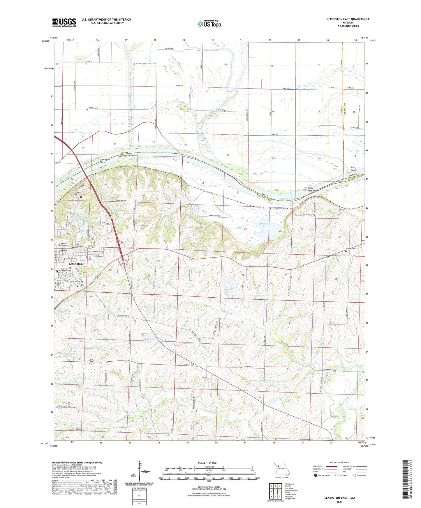
2021 topographic map quadrangle Lexington East in the state of Missouri. Scale: 1:24000. Based on the newly updated USGS 7.5' US Topo map series, this map is in the following counties: Lafayette, Ray, Carroll. The map contains contour data, water features, and other items you are used to seeing on USGS maps, but also has updated roads and other features. This is the next generation of topographic maps. Printed on high-quality waterproof paper with UV fade-resistant inks.
Quads adjacent to this one:
West: Lexington West
Northwest: Richmond
North: Hardin
Northeast: Norborne
East: Dover
Southeast: Higginsville
South: Mayview
Southwest: Odessa North
Contains the following named places: Burns School, Carter Lake Section 10 Lower Dam, Carter Lake Section 10 Upper Dam, Carter Lake Section 11 Dam, Carter Lake Section 25 Lower Dam, Carter Lake Section 25 Upper Dam, City of Lexington, Crooked River, Crystal Lakes Dam, Dickmeyer Lake, Forest Grove Cemetery, Garrison Creek, Halls, Hicklin Lake, Hicklin School, KCAC-FM (Lexington), KLEX-AM (Lexington), Ladys Lake Dam, Lafayette D10 Lake, Leslie Bell Elementary School, Lex La - Ray Technical Center, Lexington Bend, Lexington City Park Dam, Lexington High School, Lexington Middle School, Lexington Police Department, Lick Fork, Lions Club Lake Number 10298, Locust Grove School, Long Branch, Mallory School, Northrup, Number 140 Reservoir, Number 141 Reservoir, Number 143 Reservoir, Number 185 Reservoir, Oak Grove School, Palmer Sill Lake, Petsch Dam, Prairie Valley School, Sam Smiths Lake, Sauk Prairie, Sheep Nose Bend, Slusher Cemetery, Slusher School, Starke Lake Dam, Tabo Bend, Tabo Creek Watershed Structure A-22 Dam, Tabo Creek Watershed Structure C-25 Dam, Tabo Creek Watershed Structure C-27 Dam, Tabo Creek Watershed Structure C-28 Dam, Tabo Creek Watershed Structure C-29 Dam, Tabo Creek Watershed Structure C-33 Dam, Tabo Creek Watershed Structure D-20 Dam, Tabo Creek Watershed Structure D-23 Dam, Tabo Creek Watershed Structure D-24 Dam, Tabo Creek Watershed Structure D-26 Dam, Tabo Creek Watershed Structure D-28 Dam, Tabo Creek Watershed Structure D-29 Dam, Tabo Creek Watershed Structure D-30 Dam, Township of Lexington, Wentworth Country Club, Wentworth Military Academy, Winton, ZIP Code: 64067