MyTopo
Locust Hill Missouri US Topo Map
Couldn't load pickup availability
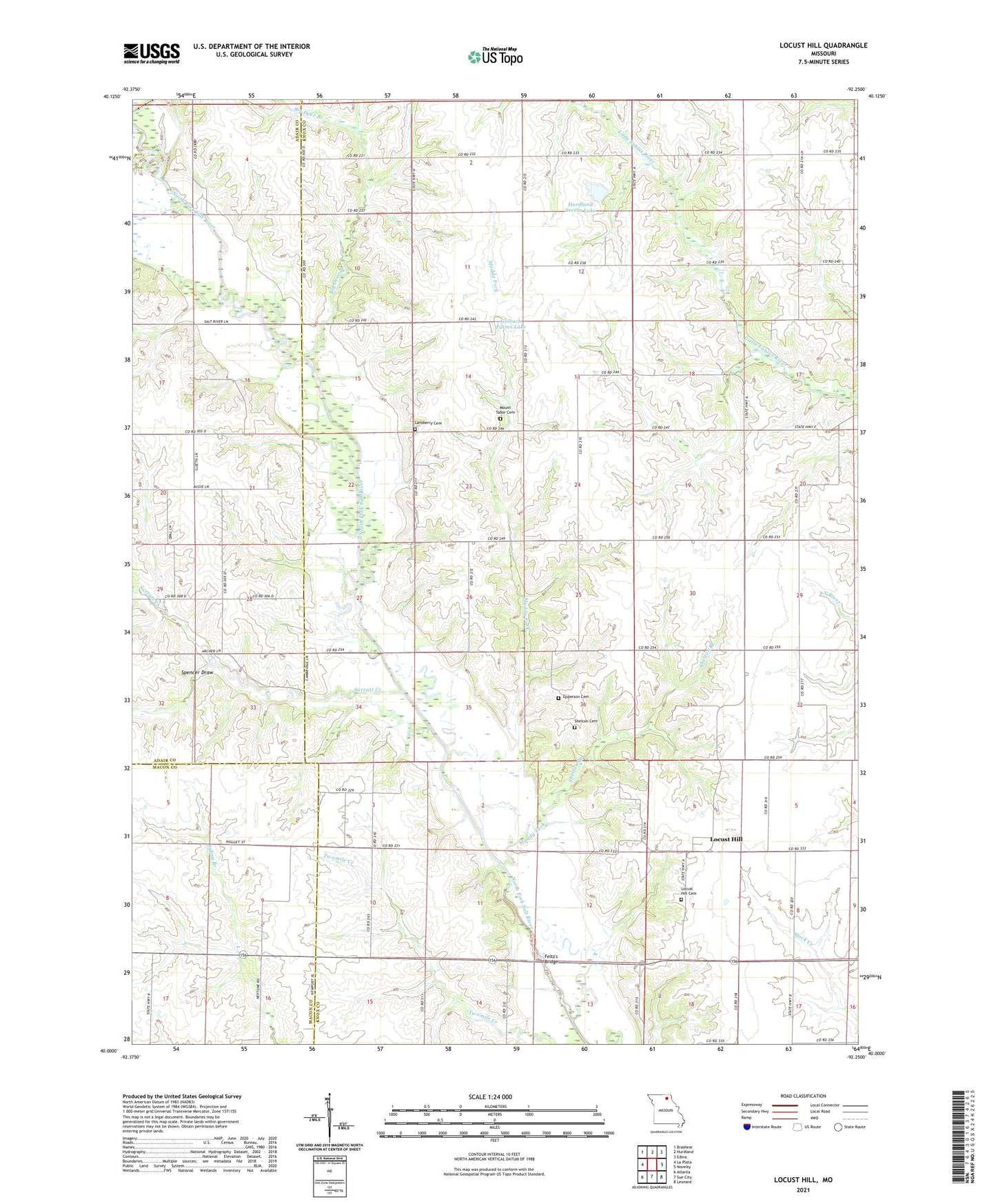
2021 topographic map quadrangle Locust Hill in the state of Missouri. Scale: 1:24000. Based on the newly updated USGS 7.5' US Topo map series, this map is in the following counties: Knox, Adair, Macon. The map contains contour data, water features, and other items you are used to seeing on USGS maps, but also has updated roads and other features. This is the next generation of topographic maps. Printed on high-quality waterproof paper with UV fade-resistant inks.
Quads adjacent to this one:
West: La Plata
Northwest: Brashear
North: Hurdland
Northeast: Edina
East: Novelty
Southeast: Leonard
South: Sue City
Southwest: Atlanta
Contains the following named places: Big Deer Branch, Bitler School, Epperson Cemetery, Fairview School, Feltz's Bridge, Gelbach Farms Lake, Gelbach Farms Lake Dam, Hall Airport, Harrison Airport, Hurdland Severs Lake, Hurdland Severs Lake Dam, Lansberry Cemetery, Locust Hill, Locust Hill Cemetery, Locust Hill Church, Mount Taber Church, Mount Tabor Cemetery, Mount Vernon School, Muddy Fork, New Harmony Church, Pinkston School, Prairie View School, Shelton Branch, Shelton Cemetery, Spencer Draw, Star School, Surratt Creek, Township of Shelton, Van Horn School