MyTopo
Novelty Missouri US Topo Map
Couldn't load pickup availability
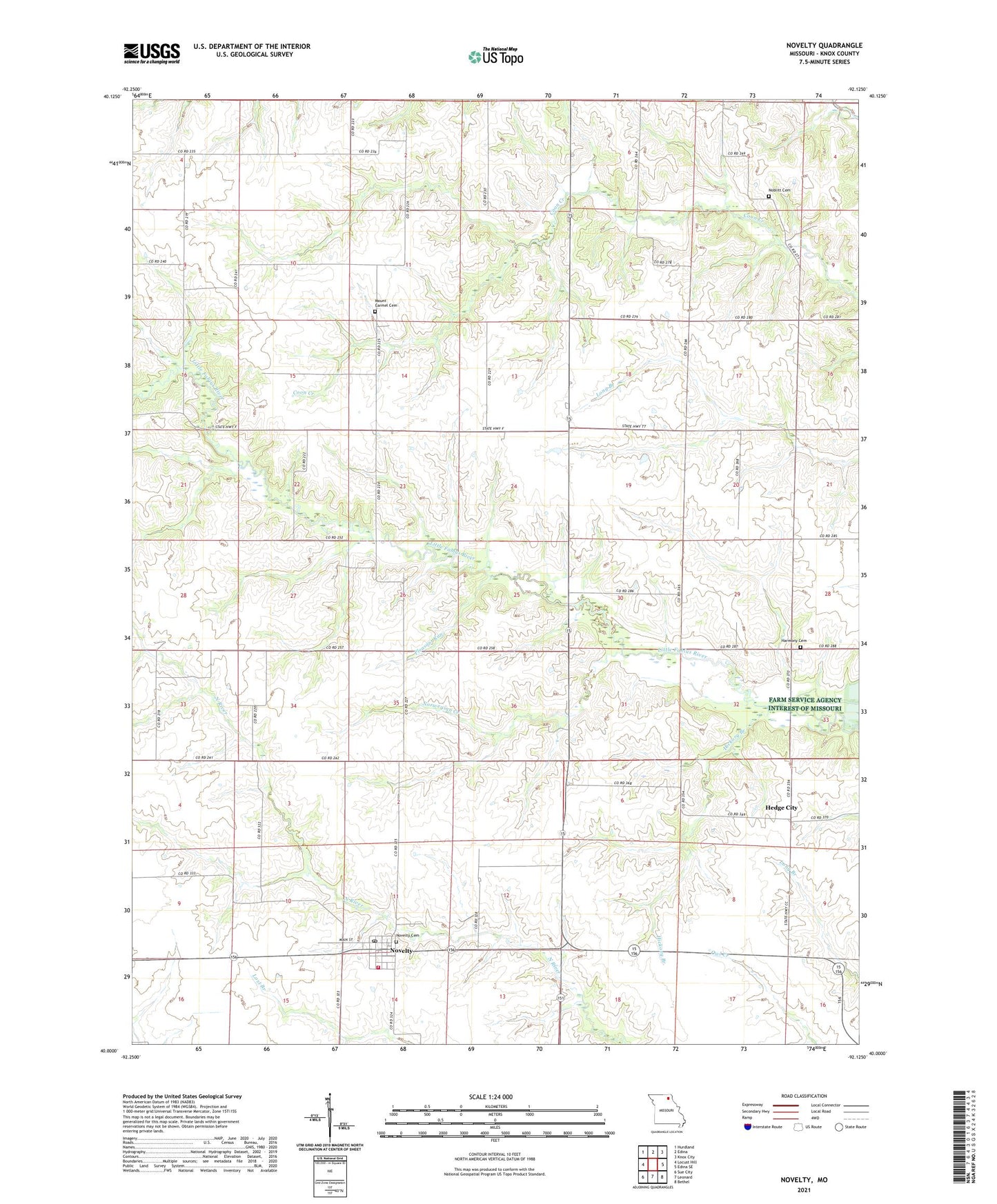
2021 topographic map quadrangle Novelty in the state of Missouri. Scale: 1:24000. Based on the newly updated USGS 7.5' US Topo map series, this map is in the following counties: Knox. The map contains contour data, water features, and other items you are used to seeing on USGS maps, but also has updated roads and other features. This is the next generation of topographic maps. Printed on high-quality waterproof paper with UV fade-resistant inks.
Quads adjacent to this one:
West: Locust Hill
Northwest: Hurdland
North: Edina
Northeast: Knox City
East: Edina SE
Southeast: Bethel
South: Leonard
Southwest: Sue City
This map covers the same area as the classic USGS quad with code o40092a2.
Contains the following named places: Barnhill School, Coburn School, Cook School, Coon Creek Roadside Park, Douglas Lake, Douglas Lake Dam, Greenly Farm Lake, Greenly Farm Lake Dam, Harmony Cemetery, Harmony Church, Hedge City, Hickory Branch, Maple Grove School, Mount Carmel Cemetery, Mount Carmel Church, Noblitt Cemetery, Norwegian Creek, Novelty, Novelty Cemetery, Novelty Post Office, Novelty Rural Fire Department, Number 76 Dam, Pleasant Run, Rimer School, Rourke School, Sharp School, Taylor School, Village of Novelty