MyTopo
La Plata Missouri US Topo Map
Couldn't load pickup availability
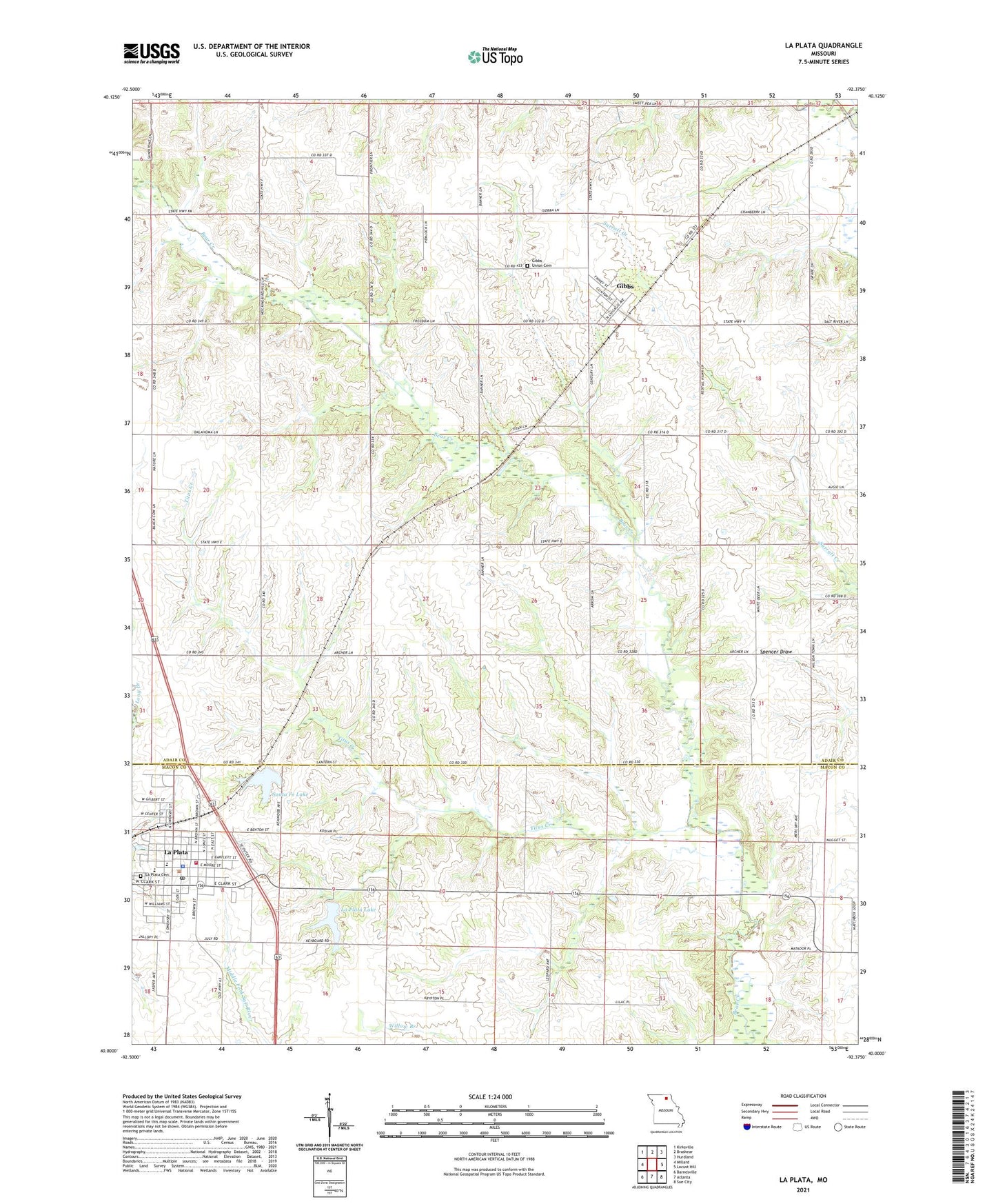
2021 topographic map quadrangle La Plata in the state of Missouri. Scale: 1:24000. Based on the newly updated USGS 7.5' US Topo map series, this map is in the following counties: Adair, Macon. The map contains contour data, water features, and other items you are used to seeing on USGS maps, but also has updated roads and other features. This is the next generation of topographic maps. Printed on high-quality waterproof paper with UV fade-resistant inks.
Quads adjacent to this one:
West: Millard
Northwest: Kirksville
North: Brashear
Northeast: Hurdland
East: Locust Hill
Southeast: Sue City
South: Atlanta
Southwest: Barnesville
This map covers the same area as the classic USGS quad with code o40092a4.
Contains the following named places: Banner School, Blanket Grove School, Brown Lake Dam, City of La Plata, Gibbs, Gibbs Union Cemetery, Gopher Hill School, Highland School, Kelley Lake Dam, La Plata, La Plata City Lake, La Plata City Reservoir East Dam, La Plata Community Fire District, La Plata Lake, La Plata Police Department, La Plata Post Office, Laplata Lake Dam, Love Valley School, Oklahoma School, Pleasant View Church, Prairie Bird, Prairie Bird School, Santa Fe Lake, Santa Fe Lake Dam, Thomas Lake Dam, Timber Branch, Titus Creek, Township of Wilson, Village of Gibbs, West Lake Dam, Wilson, Wilsontown Church, Wood Lake Dam, ZIP Codes: 63540, 63549