MyTopo
Lonedell Missouri US Topo Map
Couldn't load pickup availability
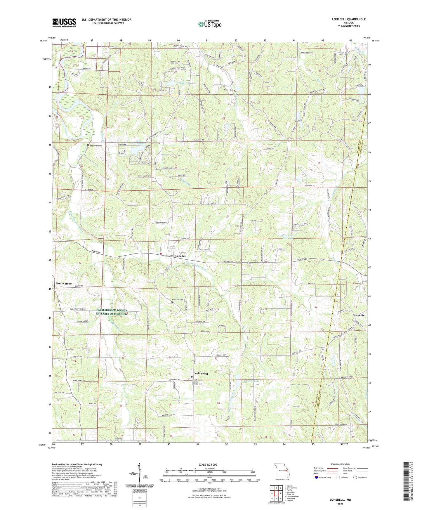
2021 topographic map quadrangle Lonedell in the state of Missouri. Scale: 1:24000. Based on the newly updated USGS 7.5' US Topo map series, this map is in the following counties: Franklin, Jefferson. The map contains contour data, water features, and other items you are used to seeing on USGS maps, but also has updated roads and other features. This is the next generation of topographic maps. Printed on high-quality waterproof paper with UV fade-resistant inks.
Quads adjacent to this one:
West: Saint Clair
Northwest: Moselle
North: Gray Summit
Northeast: Pacific
East: Cedar Hill
Southeast: Fletcher
South: Richwoods
Southwest: Cyclone Hollow
This map covers the same area as the classic USGS quad with code o38090c7.
Contains the following named places: Al Swantner Reservoir, Anderson Lake Dam, Calvey, Diamond School, Drake School, Emmett Brison Dam, Emmett Brison Reservoir, Fairview Church, Faith Revival Center, Finney Cemetery, G Williams Dam, Grubville, Hemker, Hickory Flat School, Johnson Branch, Lake Arrowhead, Lake Arrowhead Dam, Lake Marion Dam, Lake Torino, Lake Torino Dam, Lake Von Der Rosa Dam, Little Meramec River, Lone Dell Camp, Lonedell, Lonedell Lookout Tower, Lonedell Post Office, Luebbering, Mount Hope, Mount Olive Church, Mount Pleasant School, Oak Grove Cemetery, Oak Grove Church, Pierce Creek, Prairie School, Rockford School, Saint Clair Fire Protection District Station 2, Saint Francis of Assisi Catholic Cemetery, School R-14, Swantner Lake Dam, Sycamore School, Township of Prairie, Von Der Ahe Dam, Von Der Rosa Number 2 Reservoir, Von Derosa Number 2 Lake Dam, Von Derosa Number 3 Lake Dam, Waits Sawmill, Watters Lake Dam, Williams Lake, Willow Ford, Woodcock Cemetery, ZIP Codes: 63041, 63061, 63072