MyTopo
Loose Creek Missouri US Topo Map
Couldn't load pickup availability
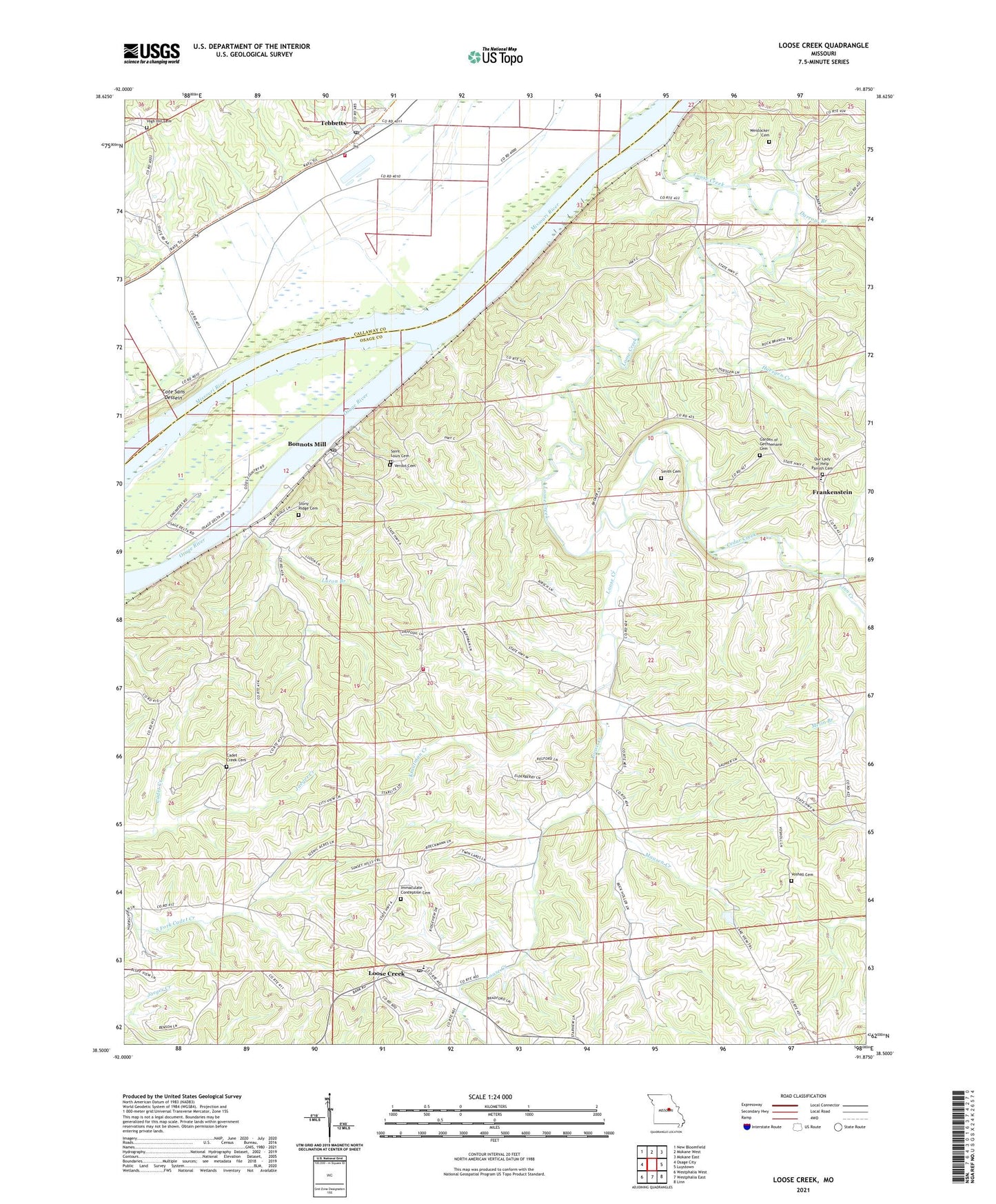
2021 topographic map quadrangle Loose Creek in the state of Missouri. Scale: 1:24000. Based on the newly updated USGS 7.5' US Topo map series, this map is in the following counties: Osage, Callaway. The map contains contour data, water features, and other items you are used to seeing on USGS maps, but also has updated roads and other features. This is the next generation of topographic maps. Printed on high-quality waterproof paper with UV fade-resistant inks.
Quads adjacent to this one:
West: Osage City
Northwest: New Bloomfield
North: Mokane West
Northeast: Mokane East
East: Luystown
Southeast: Linn
South: Westphalia East
Southwest: Westphalia West
Contains the following named places: Boillot School, Bonnots Mill, Bonnots Mill Post Office, Cadet Creek Cemetery, Cadet Creek School, Camp Ground School, Cedar Creek, Cote Sans Dessein, Cote Sans Dessein Prairie, Darrow Branch, Dodds Island, Enterprise School, Frankenstein, French Village, Garden of Gethsemane Cemetery, High Hill Cemetery, High Point Church, Huesgen Creek, Immaculate Conception Cemetery, Isbell, Jaeger Creek, Krautman Creek, Kuper-Scott Ranch Dam, Kuper-Scott Ranch Lake, Linn Creek, Linn Fire Protection District Station 2, Loose Creek, Loose Creek Post Office, Luzon Branch, Maasen Creek, Muenks Dam, Oak Grove School, Osage River, Saint Louis Catholic Church, Saint Louis Cemetery, Smith Cemetery, South Callaway Fire Protection District Station 2, Tebbetts, Tebbetts Census Designated Place, Tebbetts Post Office, Tebbetts School, Township of Linn, Verdot Cemetery, Vosholl, Vosholl Church, Weislocker Cemetery, Zion Hope Church, ZIP Code: 65016