MyTopo
Luystown Missouri US Topo Map
Couldn't load pickup availability
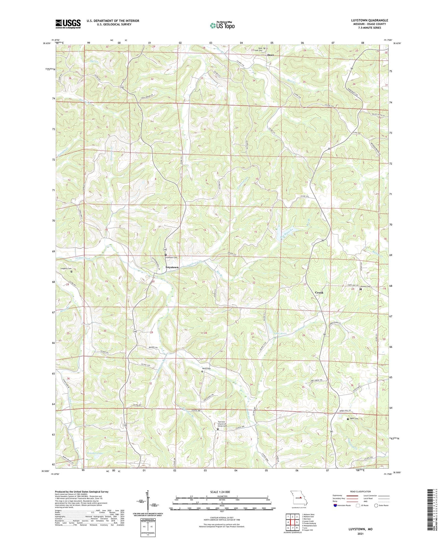
2021 topographic map quadrangle Luystown in the state of Missouri. Scale: 1:24000. Based on the newly updated USGS 7.5' US Topo map series, this map is in the following counties: Osage. The map contains contour data, water features, and other items you are used to seeing on USGS maps, but also has updated roads and other features. This is the next generation of topographic maps. Printed on high-quality waterproof paper with UV fade-resistant inks.
Quads adjacent to this one:
West: Loose Creek
Northwest: Mokane West
North: Mokane East
Northeast: Morrison
East: Fredericksburg
Southeast: Cooper Hill
South: Linn
Southwest: Westphalia East
This map covers the same area as the classic USGS quad with code o38091e7.
Contains the following named places: Agee Cemetery, Baileys Creek, Ben Branch, Boes School, Crook, Deer, Deer Creek Cemetery, Deer Creek School, Fairgrove Branch, Fairview Branch, Fairview Church, Flat Rock School, Flora School, Franken Lake, Franken Lake Dam, Georgetown School, Indian Creek, Lake Acres, Lake Acres Dam, Laughlin Cemetery, Luystown, Luystown Creek, Melin Branch, Mint Hill Church, Mount Pleasant School, Peachland, Perry Cemetery, Shirley Cemetery, Troesser Creek, Union Church, ZIP Code: 65024