MyTopo
Linn Missouri US Topo Map
Couldn't load pickup availability
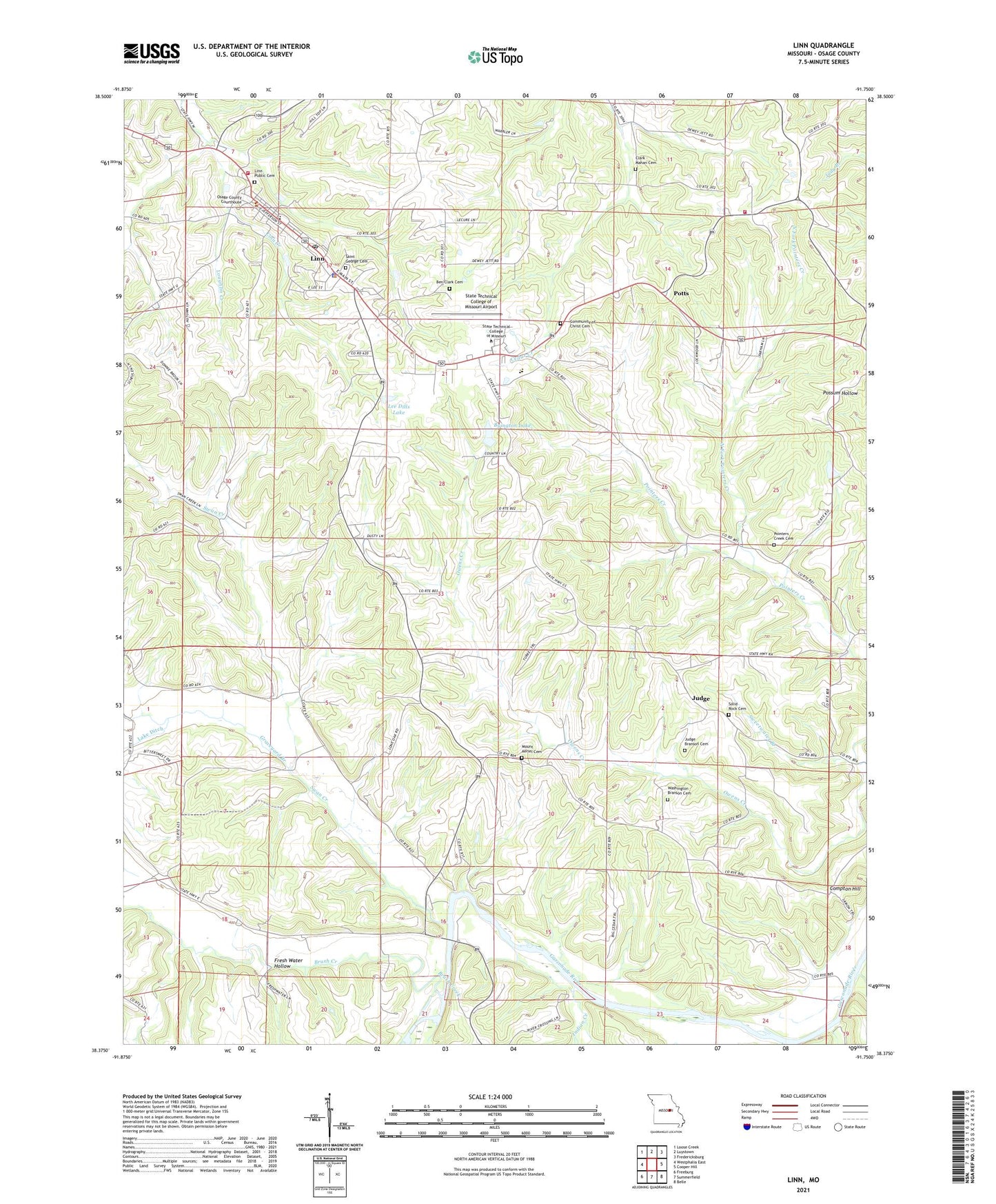
2021 topographic map quadrangle Linn in the state of Missouri. Scale: 1:24000. Based on the newly updated USGS 7.5' US Topo map series, this map is in the following counties: Osage. The map contains contour data, water features, and other items you are used to seeing on USGS maps, but also has updated roads and other features. This is the next generation of topographic maps. Printed on high-quality waterproof paper with UV fade-resistant inks.
Quads adjacent to this one:
West: Westphalia East
Northwest: Loose Creek
North: Luystown
Northeast: Fredericksburg
East: Cooper Hill
Southeast: Belle
South: Summerfield
Southwest: Freeburg
This map covers the same area as the classic USGS quad with code o38091d7.
Contains the following named places: Ben Clark Cemetery, Brush Creek, Buck Creek, Byington Lake, Byington Lake Dam, City of Linn, Clark - Mahan Cemetery, Compton Hill, Forest Grove School, Fresh Water Hollow, Graveyard Branch, Indian Creek, Judge, Judge Branson Cemetery, Latter Day Saints Church, Leboeuf Creek, Lee Dills Dam, Lee Dills Lake, Linn, Linn Fire Protection District Station 1, Linn Fire Protection District Station 3, Linn Nursing Home, Linn Police Department, Linn Post Office, Linn Public Cemetery, Linn Technical College, Lone Star School, Loughlin Creek, Missouri Department of Conservation Forestry Central Regional Field Fire Office Linn, Mount Aerial Church, Mount Aerial School, Mount Aeriel Cemetery, North Fork Pointers Creek, Osage Country Club, Osage County, Osage County Sheriff's Office, Owen Mills, Pointers Creek Cemetery, Pointers Creek School, Potts, Potts School, Rohlfing Dam, Rollins Ferry Public Access Area, Saint Georges Catholic Church, Solid Rock Cemetery, State Technical College of Missouri Airport, Swan Creek, Swan Lake, Sweetwater Branch, Thurman L Willett Fieldhouse, Township of Crawford, Victor School, Washington - Branson Cemetery, ZIP Code: 65051