MyTopo
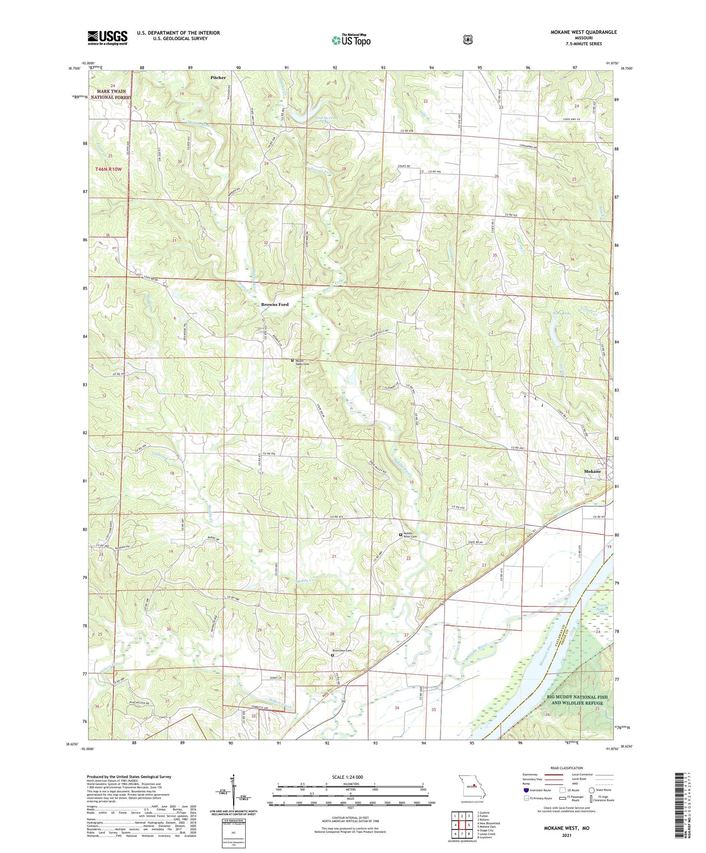
Mokane West Missouri US Topo Map
Couldn't load pickup availability
2021 topographic map quadrangle Mokane West in the state of Missouri. Scale: 1:24000. Based on the newly updated USGS 7.5' US Topo map series, this map is in the following counties: Callaway, Osage. The map contains contour data, water features, and other items you are used to seeing on USGS maps, but also has updated roads and other features. This is the next generation of topographic maps. Printed on high-quality waterproof paper with UV fade-resistant inks.
Quads adjacent to this one:
West: New Bloomfield
Northwest: Guthrie
North: Fulton
Northeast: Reform
East: Mokane East
Southeast: Luystown
South: Loose Creek
Southwest: Osage City
Contains the following named places: Browns Ford, Effie, Ewing Creek, Gallons Creek, Held Dam, Henke Lake Dam, Herring School, Hillers Creek, Holman School, Hord, Hord School, Katy Lake, Katy Lake Dam, Liberty, Liberty Church, Liberty School, Middle River, Middle River Cemetery, Middle River Church, Moore School, Mount Tabor Cemetery, Muddy Creek, Musick, Oakley Church, Paul Herring Lake, Prairie Fork, Prentiss, Prime Creek, Riverview Cemetery, Snyder Creek, South Callaway Elementary School, South Callaway High School, South Callaway Middle School, Thornhill School, Township of Cote Sans Dessein, Township of Saint Aubert, ZIP Code: 65080