MyTopo
Reform Missouri US Topo Map
Couldn't load pickup availability
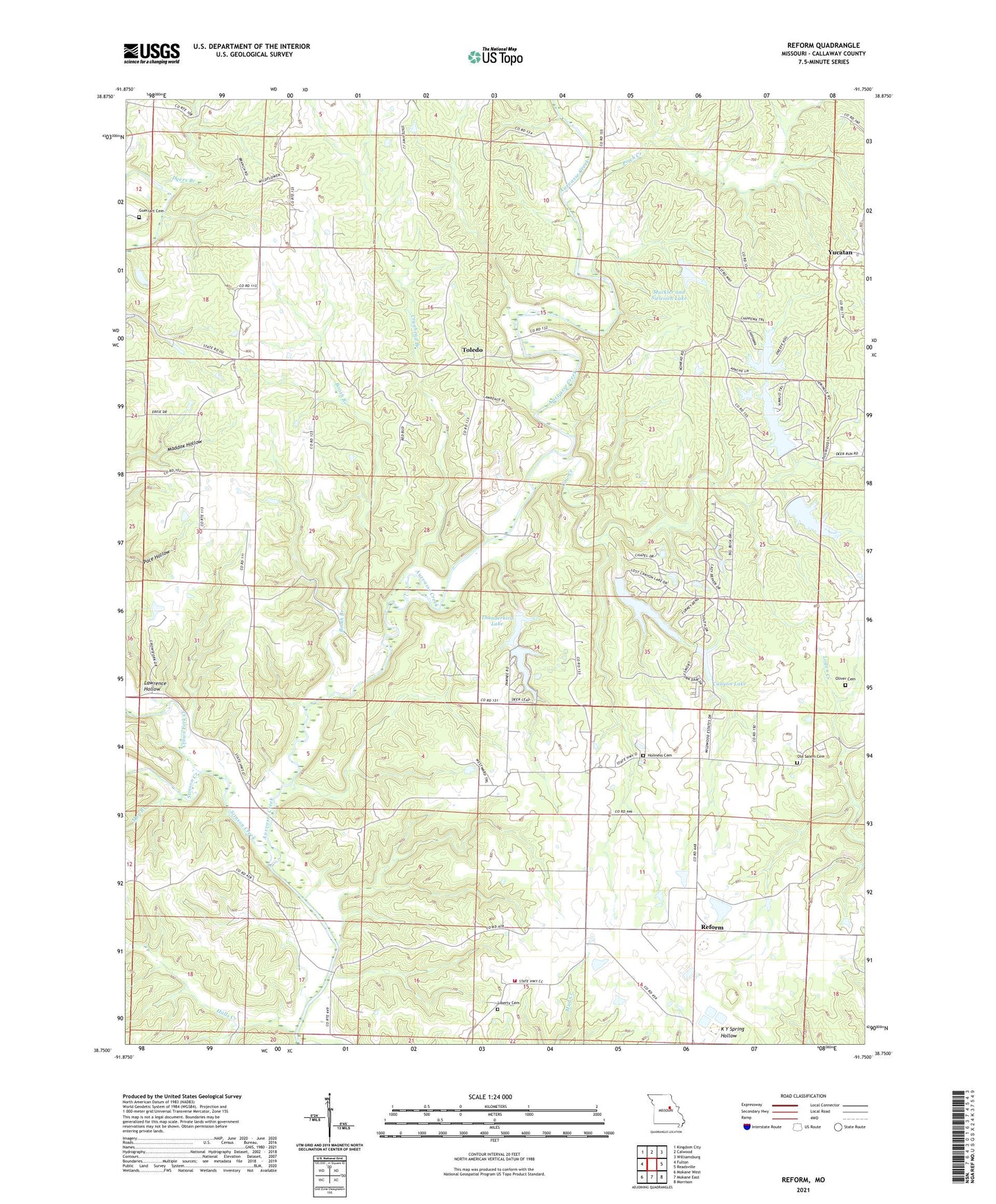
2021 topographic map quadrangle Reform in the state of Missouri. Scale: 1:24000. Based on the newly updated USGS 7.5' US Topo map series, this map is in the following counties: Callaway. The map contains contour data, water features, and other items you are used to seeing on USGS maps, but also has updated roads and other features. This is the next generation of topographic maps. Printed on high-quality waterproof paper with UV fade-resistant inks.
Quads adjacent to this one:
West: Fulton
Northwest: Kingdom City
North: Calwood
Northeast: Williamsburg
East: Readsville
Southeast: Morrison
South: Mokane East
Southwest: Mokane West
This map covers the same area as the classic USGS quad with code o38091g7.
Contains the following named places: Ashland School, Booth Branch, Brooks School, Canyon Lake, Canyon Lake Lower Dam, Canyon Lake Upper Dam, Church of God, Cow Creek, Craghead Branch, Crows Fork Creek, Dyers Branch, Gregory School, Guerrart Cemetery, Halls Creek, Herring Lake Dam, Holiness Cemetery, Konrad Dam, Lake Lochaweeno, Lake Lochaweeno Dam, Lake Thunderbird Upper Dam, Lawrence Dam, Lawrence Hollow, Lee Sualts Dam, Liberty Cemetery, Lost Canyon Lakes Section 25 Upper Dam, Lost Canyon Lakes Section 26 East Dam, Lost Canyon Lakes Section 26 West Dam, May Branch, Mirts Lake Dam, Muckler and Sieleisch Lake, Muckler and Sielfleisch Lake Dam, Old Salem Cemetery, Oliver Cemetery, Pinch Creek, Pugh School, Red Star School, Reform, Reform School, Science Hill School, Sielfleisch Lake Section 25 Dam, South Callaway Fire Protection District Station 5, Stinson Creek, Thunderbird Lake, Thunderbird Lake Dam, Toledo, Toledo School, Winfield Investment Lake Dam, Yucatan, ZIP Code: 65077