MyTopo
Mount Moriah Missouri US Topo Map
Couldn't load pickup availability
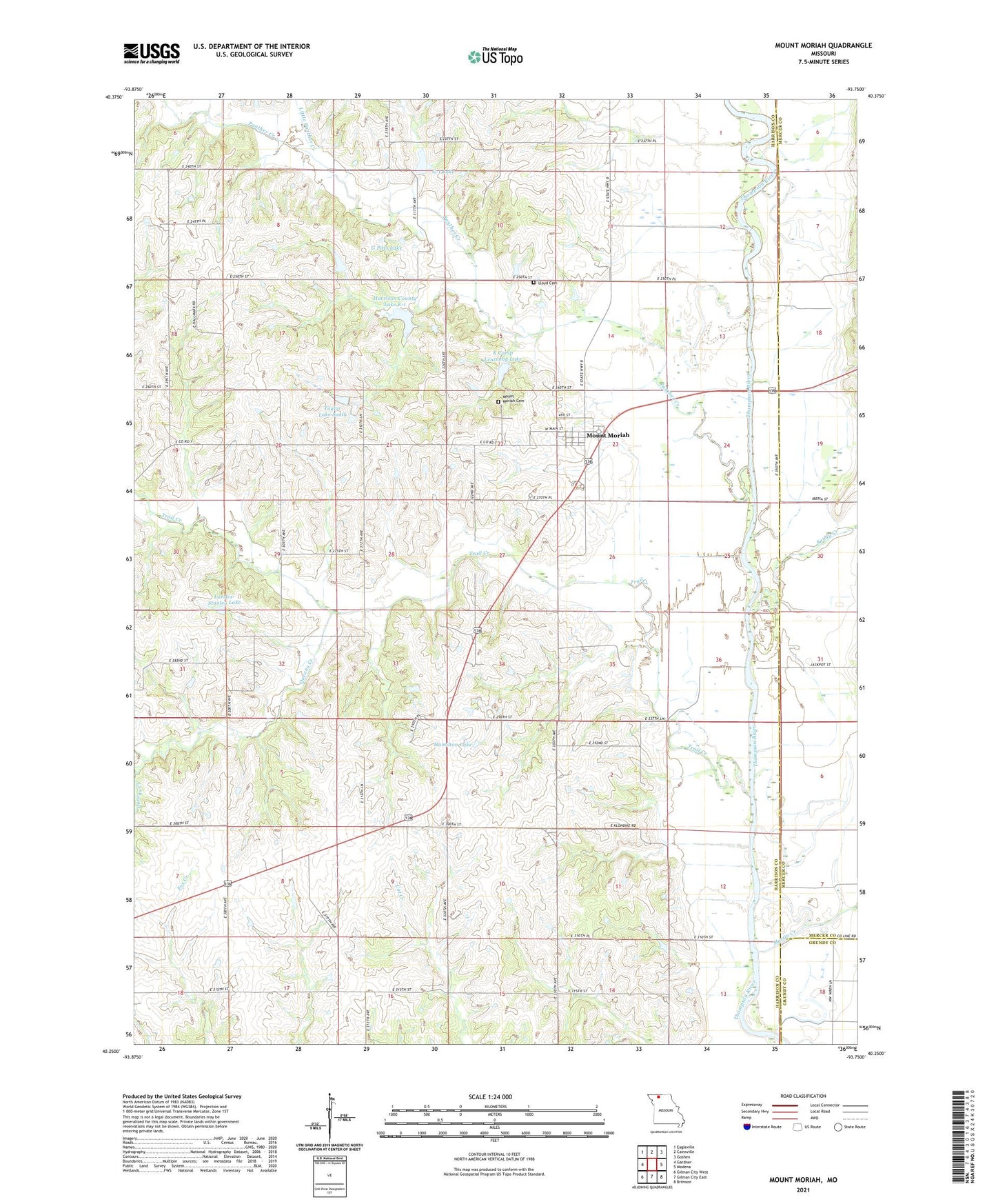
2021 topographic map quadrangle Mount Moriah in the state of Missouri. Scale: 1:24000. Based on the newly updated USGS 7.5' US Topo map series, this map is in the following counties: Harrison, Mercer, Grundy. The map contains contour data, water features, and other items you are used to seeing on USGS maps, but also has updated roads and other features. This is the next generation of topographic maps. Printed on high-quality waterproof paper with UV fade-resistant inks.
Quads adjacent to this one:
West: Gardner
Northwest: Eagleville
North: Cainsville
Northeast: Goshen
East: Modena
Southeast: Brimson
South: Gilman City East
Southwest: Gilman City West
Contains the following named places: Arney Lake Dam, Battle Creek School, Brown School, Fairview School, G Pitts E-10 Dam, G Pitts Lake, G-1 Lake, Hamilton Lake, Hamilton Lake Dam, Harrison County Lake E-1, K Camp Leazenby Lake, Lake O' the Woods, Lake O' the Woods Dam, Landes Lake, Landes Lake Dam, Landes-Stanley Lake, Landes-Stanley Lake Dam, Leazenby Lake Section 14 Dam, Leazenby Lake Section 15 Dam, Leonard Lake, Leonard Lake Dam, Little Panther Creek, Lloyd Cemetery, Martin Creek, Mount Moriah, Mount Moriah Cemetery, Murphy School, Panther Creek, Panther Creek Watershed Dam E-10, Panther Creek Watershed Dam E-12, Panther Creek Watershed Dam E-2, Panther Creek Watershed Dam G-1, Panther Creek Wshd Dam E-1, Queens Creek, Sandy Creek, Sharon Church, Stoner Lake Dam, Taylor Lake Dam South, Taylor Lake South, Town of Mount Moriah, Township of Trail Creek, Trail Creek, Wooderson School