MyTopo
Brimson Missouri US Topo Map
Couldn't load pickup availability
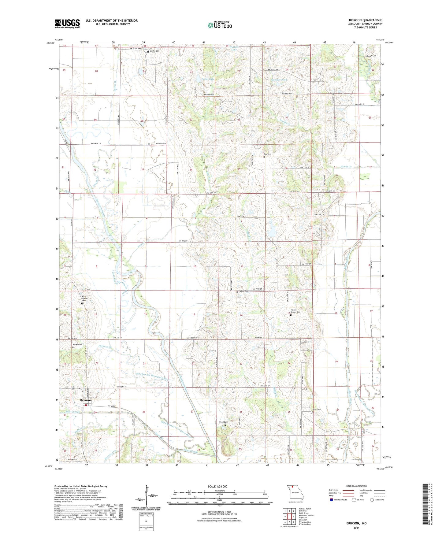
2021 topographic map quadrangle Brimson in the state of Missouri. Scale: 1:24000. Based on the newly updated USGS 7.5' US Topo map series, this map is in the following counties: Grundy. The map contains contour data, water features, and other items you are used to seeing on USGS maps, but also has updated roads and other features. This is the next generation of topographic maps. Printed on high-quality waterproof paper with UV fade-resistant inks.
Quads adjacent to this one:
West: Gilman City East
Northwest: Mount Moriah
North: Modena
Northeast: Mill Grove
East: Spickard
Southeast: Trenton East
South: Trenton West
Southwest: Bancroft
This map covers the same area as the classic USGS quad with code o40093b6.
Contains the following named places: Brimson, Buttsville, Cat Creek, Cattail Creek, Consolidated School Number 1, Crawford School, Dolan Dam, Dolan Lake, Fox Cemetery, Fox School, Furnace Creek, Griffin Cemetery, Grundy County Rural Fire Protection District Station 2, Hanes Lake Dam, Hatton Chapel, Hatton Chapel Cemetery, Hein Lake Dam, Hickory Grove School, Johnson Cemetery, Johnson School, Knightstown School, Knosby Lake Dam, Lost Creek, McVay School, Miller Cemetery, Newton School, Number 579 Dam, Old Channel Weldon River, Parkerton, Parkerton School, Peteet Creek, Preston Lake Dam, Raccoon Creek, Salem Cemetery, Salem Church, Shott, Shott School, Sires Cemetery, Stamper Lake Dam, Stamper Pond, Sugar Creek, Township of Harrison, Township of Taylor, Township of Washington, Village of Brimson, Welch Chapel, West Fairview School, Willis Chapel, Willis Chapel Cemetery, Wood Cemetery