MyTopo
Neck City Missouri US Topo Map
Couldn't load pickup availability
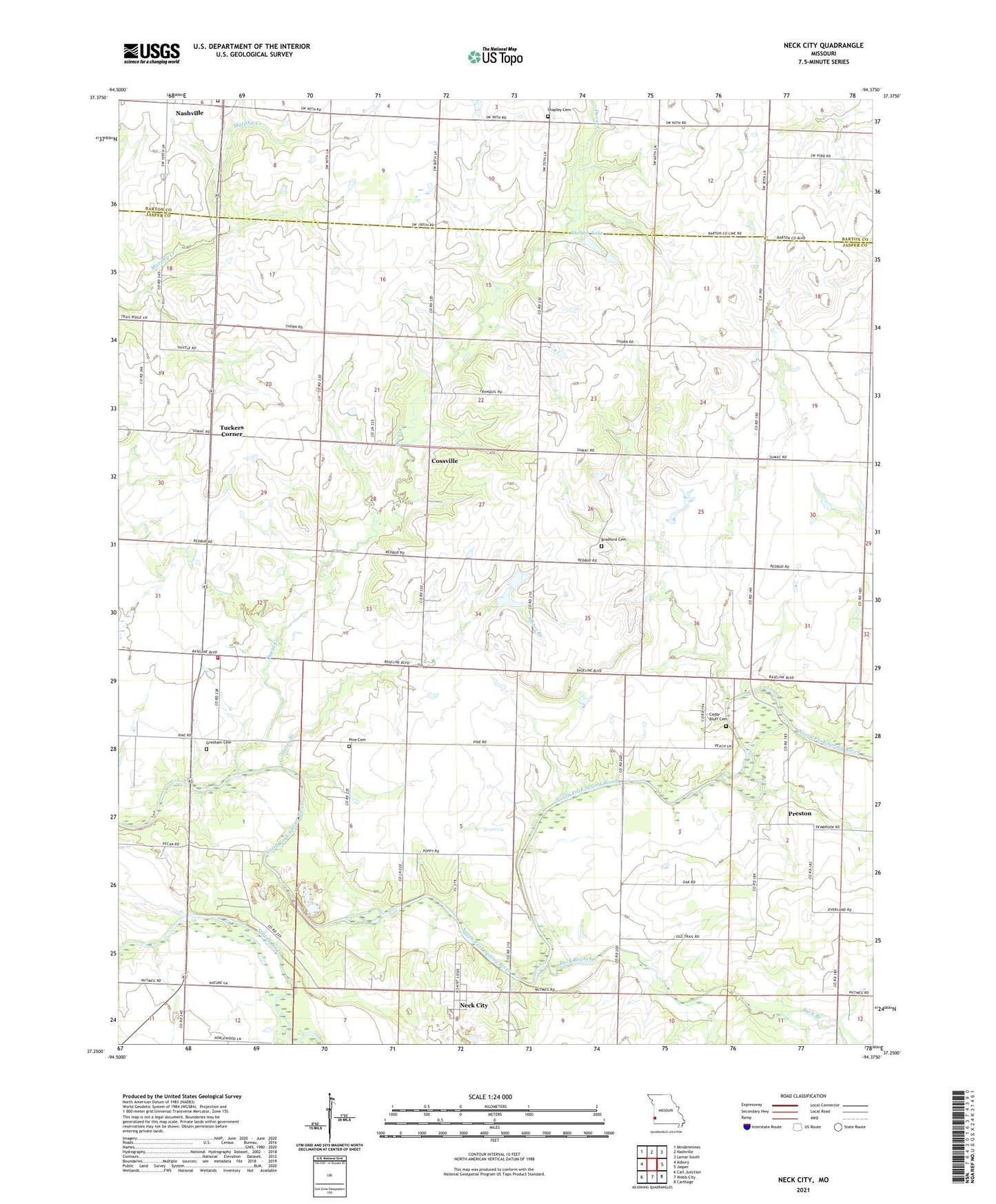
2021 topographic map quadrangle Neck City in the state of Missouri. Scale: 1:24000. Based on the newly updated USGS 7.5' US Topo map series, this map is in the following counties: Jasper, Barton. The map contains contour data, water features, and other items you are used to seeing on USGS maps, but also has updated roads and other features. This is the next generation of topographic maps. Printed on high-quality waterproof paper with UV fade-resistant inks.
Quads adjacent to this one:
West: Asbury
Northwest: Mindenmines
North: Nashville
Northeast: Lamar South
East: Jasper
Southeast: Carthage
South: Webb City
Southwest: Carl Junction
Contains the following named places: Barker Lake, Barker Lake Dam, Bradford Cemetery, Breeze, Buck Branch, Cedar Bluff Cemetery, Cedar Bluff School, City of Neck City, Cliffwood, Coon Foot School, Cossville, Diamond School, Duval Creek, Gresham Cemetery, Lynnland School, Nashville, Nashville Cemetery, Neck City, Neck City Post Office, Neck City School, New Providence Church, Pine Cemetery, Pine School, Prairie Star School, Preston, Preston School, Rosebank School, Shapley Cemetery, Shapley School, Shelton Lake, Shelton Lake Dam, Slater Branch, Township of Duval, Tri - Cities Fire Protection District Station 3, Tuckers Corner, Valley Dell School, View Bank School, ZIP Codes: 64849, 64855