MyTopo
Mindenmines Missouri US Topo Map
Couldn't load pickup availability
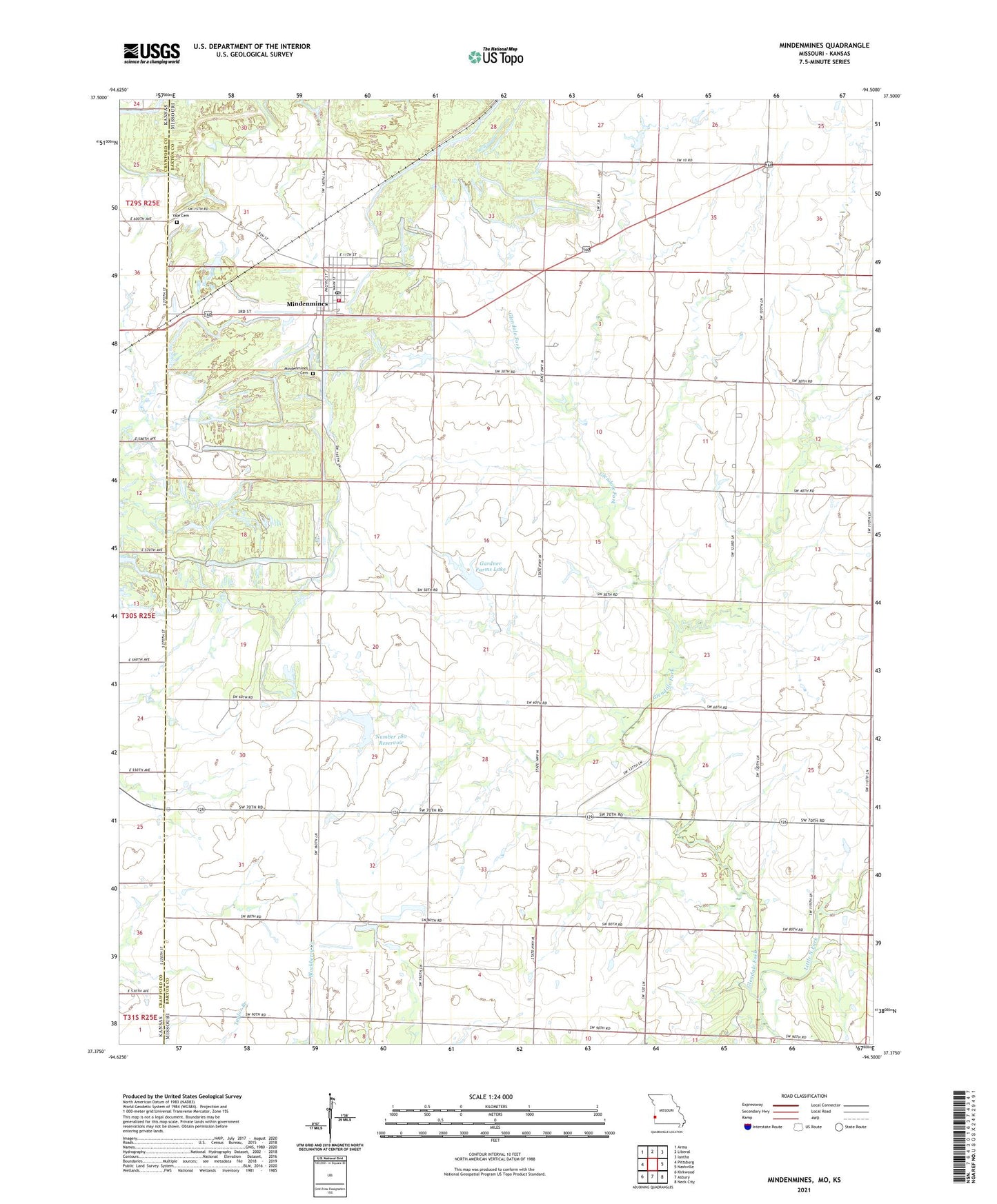
2021 topographic map quadrangle Mindenmines in the state of Missouri. Scale: 1:24000. Based on the newly updated USGS 7.5' US Topo map series, this map is in the following counties: Barton, Crawford. The map contains contour data, water features, and other items you are used to seeing on USGS maps, but also has updated roads and other features. This is the next generation of topographic maps. Printed on high-quality waterproof paper with UV fade-resistant inks.
Quads adjacent to this one:
West: Pittsburg
Northwest: Arma
North: Liberal
Northeast: Iantha
East: Nashville
Southeast: Neck City
South: Asbury
Southwest: Kirkwood
This map covers the same area as the classic USGS quad with code o37094d5.
Contains the following named places: Blackjack School, City of Mindenmines, Fairview School, Finley Lake, Gardner Farms Lake, Gardner Farms Lake Dam, Glendale Fork, Glendale School, KKUZ-FM (Joplin), Mindenmines, Mindenmines Cemetery, Mindenmines Post Office, Mindenmines Volunteer Fire Department, Moss Lake, Moss Lake Dam, Number 180 Reservoir, Prairie Center Farm Dam, Prairie Center Farm Lake, Southwest School, Township of South West, West Star School, Yale Cemetery, ZIP Code: 64769