MyTopo
Odessa South Missouri US Topo Map
Couldn't load pickup availability
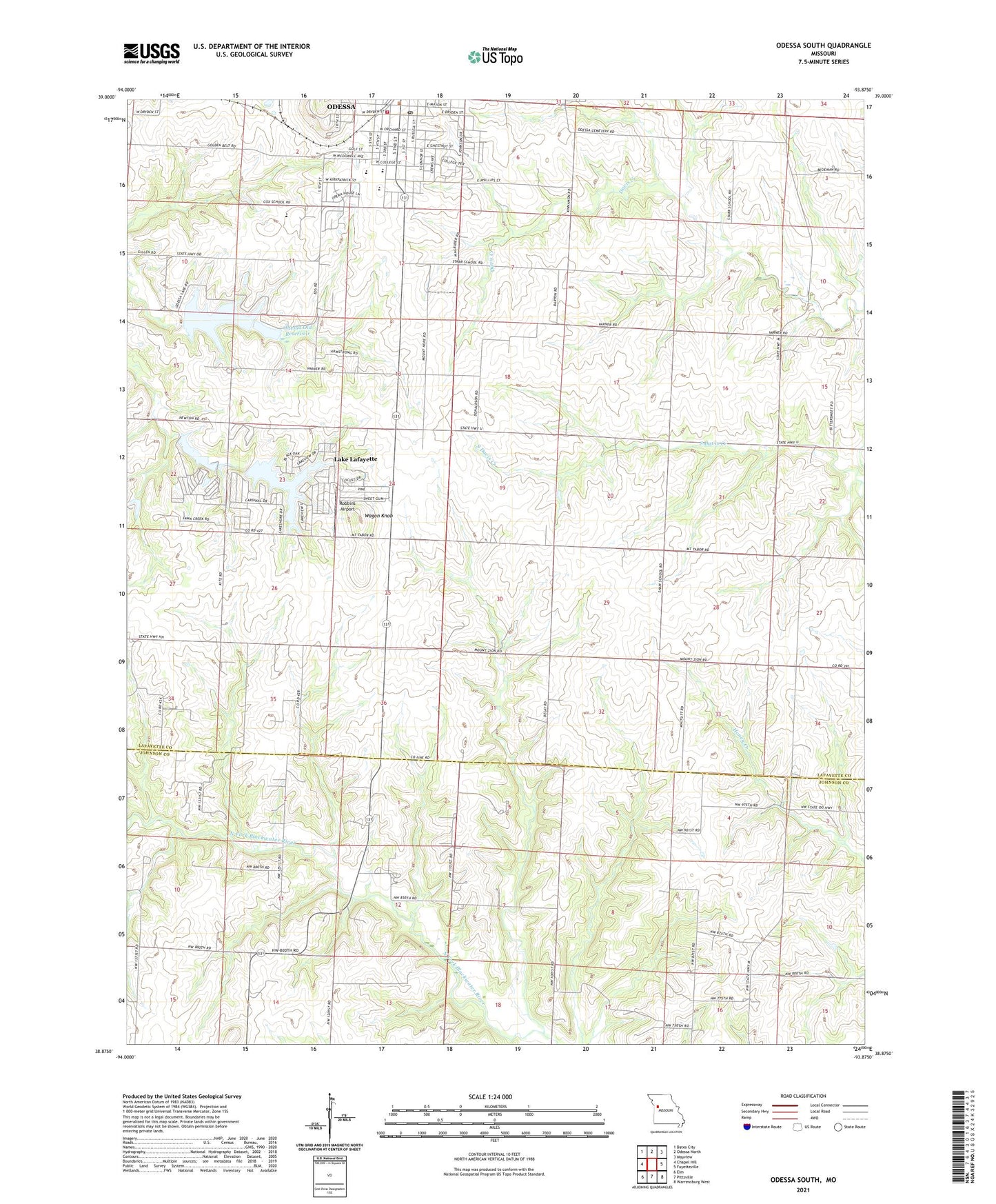
2021 topographic map quadrangle Odessa South in the state of Missouri. Scale: 1:24000. Based on the newly updated USGS 7.5' US Topo map series, this map is in the following counties: Lafayette, Johnson. The map contains contour data, water features, and other items you are used to seeing on USGS maps, but also has updated roads and other features. This is the next generation of topographic maps. Printed on high-quality waterproof paper with UV fade-resistant inks.
Quads adjacent to this one:
West: Chapel Hill
Northwest: Bates City
North: Odessa North
Northeast: Mayview
East: Fayetteville
Southeast: Warrensburg West
South: Pittsville
Southwest: Elm
Contains the following named places: Barker School, Bartlett Lake Dam, City of Lake Lafayette, City of Odessa, Cox School, Highland School, Lake Lafayette, Lake Lafayette Dam, Mary K McQuerry Elementary School, McKendree Church, Mount Tabor Church, Odessa, Odessa Dam, Odessa Fire and Rescue Protection District, Odessa High School, Odessa Middle School, Odessa Old Reservoir, Odessa Old Reservoir Dam, Odessa Post Office, Odessa Reservoir, Odessa Upper Elementary School, Payne School, Robbins Airport, Rocky Ford School, Shaw School, Sheik-Ollie Lake Dam, Starr School, Wagon Knob, Wagon Knob School, Woods Chapel, ZIP Code: 64076