MyTopo
Omaha Missouri US Topo Map
Couldn't load pickup availability
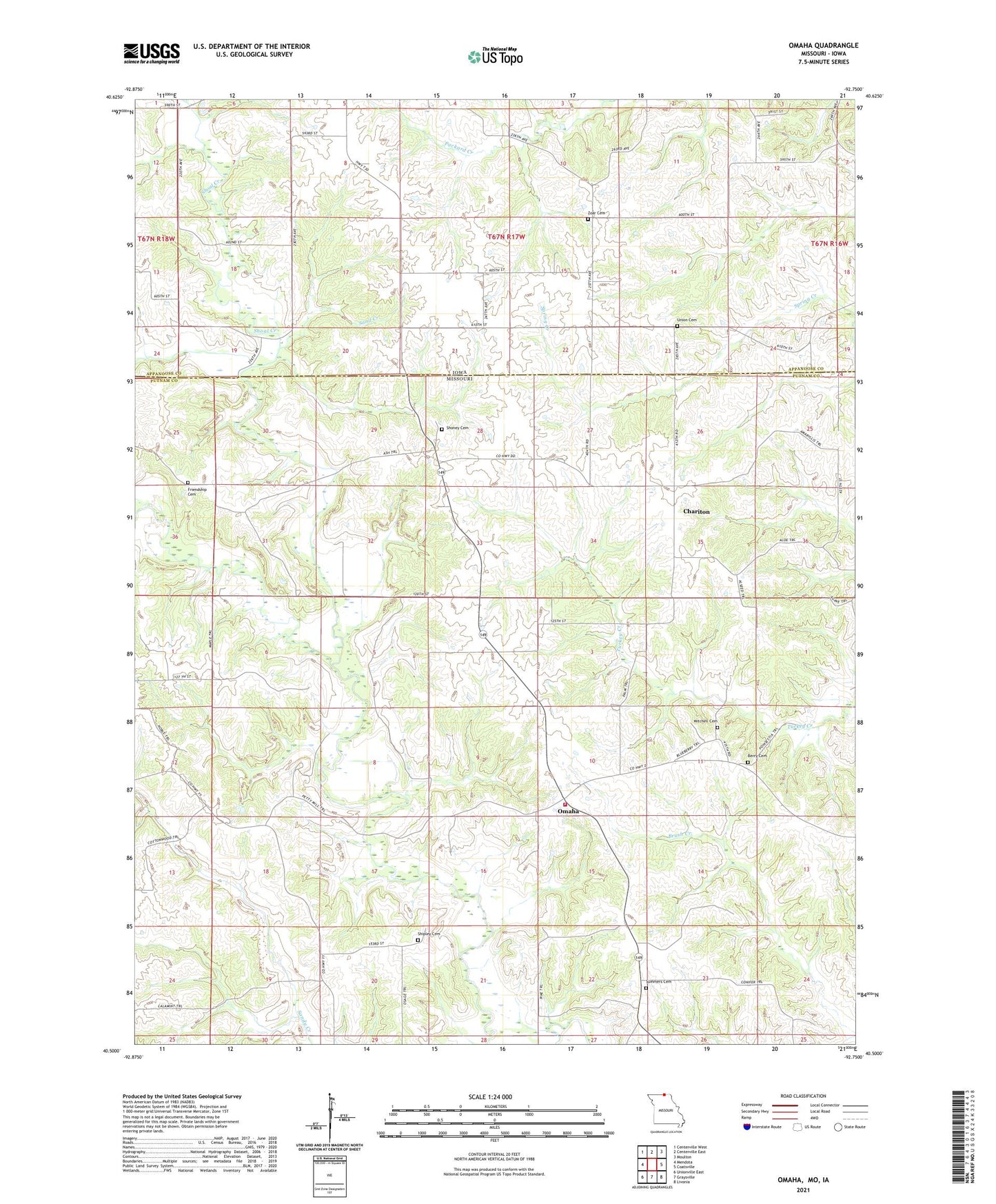
2021 topographic map quadrangle Omaha in the states of Missouri, Iowa. Scale: 1:24000. Based on the newly updated USGS 7.5' US Topo map series, this map is in the following counties: Putnam, Appanoose. The map contains contour data, water features, and other items you are used to seeing on USGS maps, but also has updated roads and other features. This is the next generation of topographic maps. Printed on high-quality waterproof paper with UV fade-resistant inks.
Quads adjacent to this one:
West: Mendota
Northwest: Centerville West
North: Centerville East
Northeast: Moulton
East: Coatsville
Southeast: Livonia
South: Graysville
Southwest: Unionville East
Contains the following named places: Abbott School, Berry Cemetery, Berry School, Chariton, Esper, Friendship Cemetery, Friendship School, Liberty Township Fire Protection District, Little Shoal Creek, Mitchell Cemetery, Mount Hermon Church, Omaha, Petty School, Sand Creek, Shipley Cemetery, Shoney Cemetery, Shoney School, Summers Cemetery, Township of Liberty, Union Cemetery, Wells School, Zoar Cemetery