MyTopo
Livonia Missouri US Topo Map
Couldn't load pickup availability
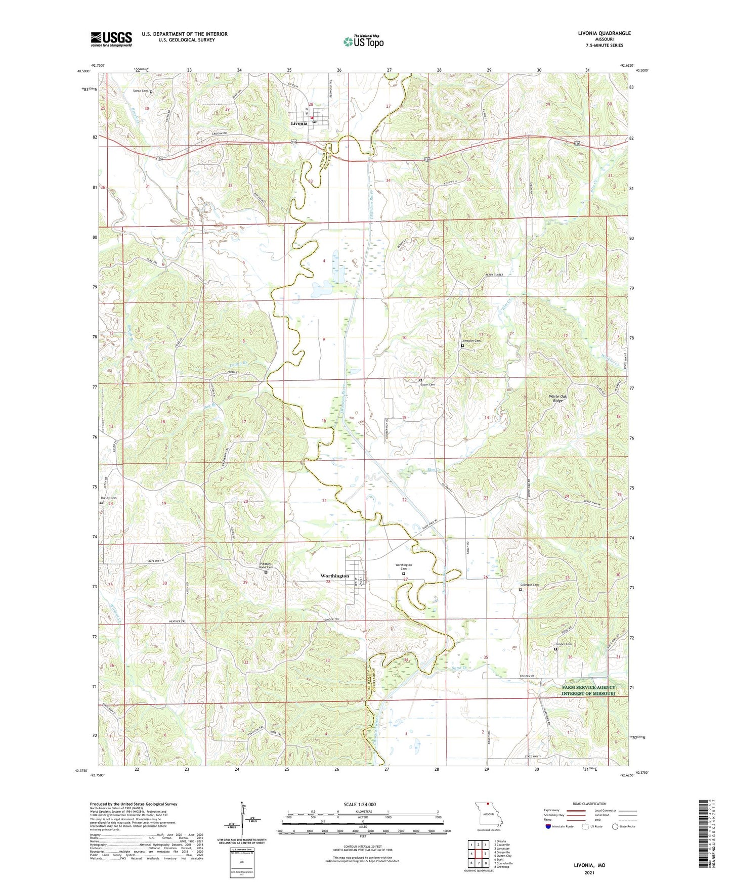
2021 topographic map quadrangle Livonia in the state of Missouri. Scale: 1:24000. Based on the newly updated USGS 7.5' US Topo map series, this map is in the following counties: Schuyler, Putnam. The map contains contour data, water features, and other items you are used to seeing on USGS maps, but also has updated roads and other features. This is the next generation of topographic maps. Printed on high-quality waterproof paper with UV fade-resistant inks.
Quads adjacent to this one:
West: Graysville
Northwest: Omaha
North: Coatsville
Northeast: Lancaster
East: Queen City
Southeast: Greentop
South: Connelsville
Southwest: Stahl
This map covers the same area as the classic USGS quad with code o40092d6.
Contains the following named places: Baugh Branch, Brasfield School, Brush Creek, Cooper Cemetery, Dog Branch, Eason Cemetery, Elm Creek, Gillespie Cemetery, Grant Township Fire District, Hartford School, Hogg School, Hurley Cemetery, Jimtown Cemetery, Jimtown School, Lickskillet, Livonia, Livonia Post Office, Logan Branch, Oak Grove School, Pleasant Home Cemetery, Power of Prayer Church, Sand Creek, Satterfield School, Shoal Creek, Slate Ford, Speak Cemetery, Tan Lake, Village of Livonia, Village of Worthington, White Oak Ridge, Winkler Creek, Worthington, Worthington Cemetery, ZIP Code: 63567