MyTopo
Unionville East Missouri US Topo Map
Couldn't load pickup availability
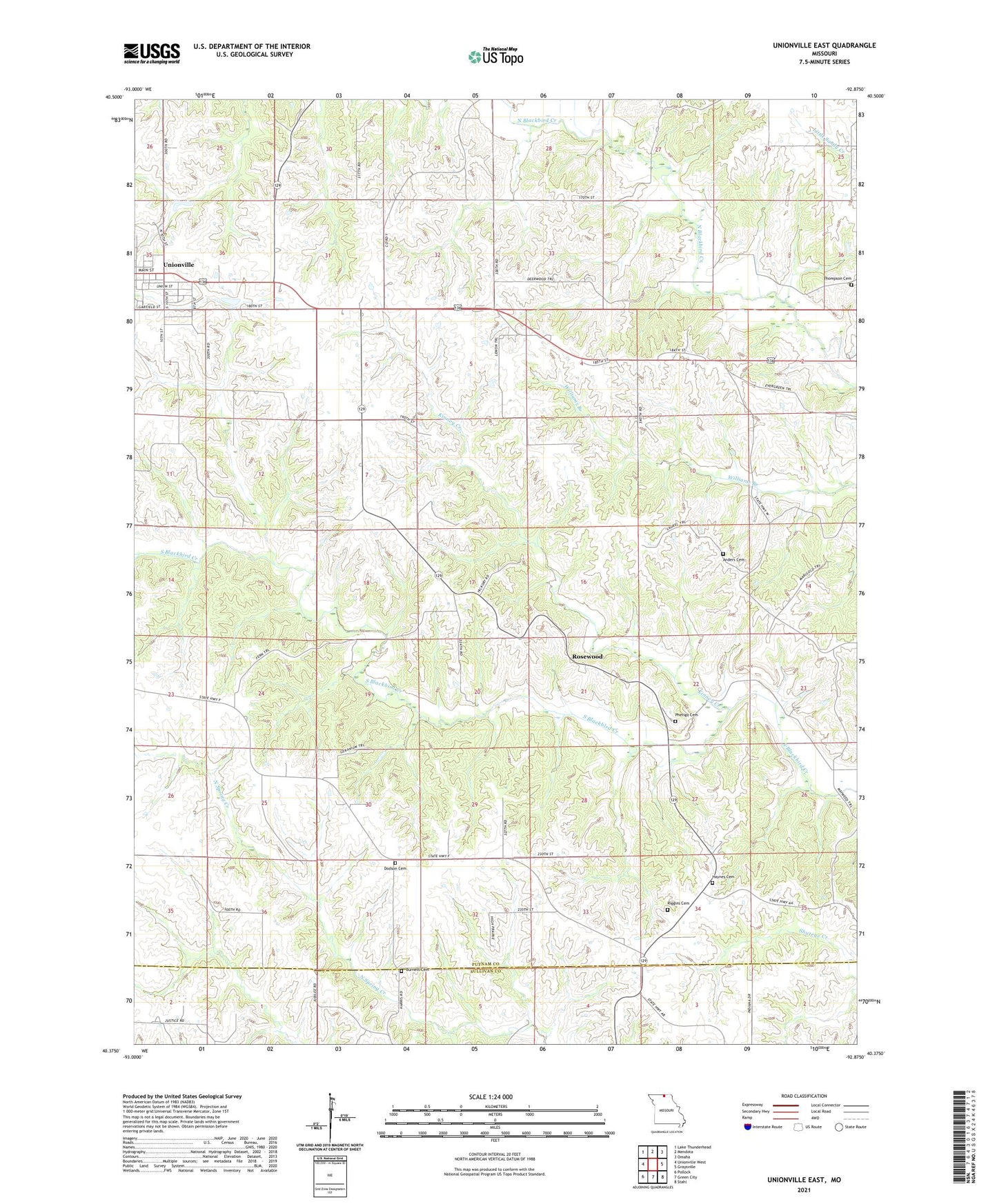
2021 topographic map quadrangle Unionville East in the state of Missouri. Scale: 1:24000. Based on the newly updated USGS 7.5' US Topo map series, this map is in the following counties: Putnam, Sullivan. The map contains contour data, water features, and other items you are used to seeing on USGS maps, but also has updated roads and other features. This is the next generation of topographic maps. Printed on high-quality waterproof paper with UV fade-resistant inks.
Quads adjacent to this one:
West: Unionville West
Northwest: Lake Thunderhead
North: Mendota
Northeast: Omaha
East: Graysville
Southeast: Stahl
South: Green City
Southwest: Pollock
This map covers the same area as the classic USGS quad with code o40092d8.
Contains the following named places: Anders Cemetery, Anders School, Blackbird School, Burnett Cemetery, Christian Home Church, Dodson Cemetery, East Dodson School, Goodhope School, Gray School, Halley School, Haynes Cemetery, Kinney Creek, Lone Star School, Pherigo Cemetery, Riggins Cemetery, Rosewood, Thompson Cemetery, Township of Richland, Union School, Victory School, West Dodson School, ZIP Code: 63565