MyTopo
Piedmont SE Missouri US Topo Map
Couldn't load pickup availability
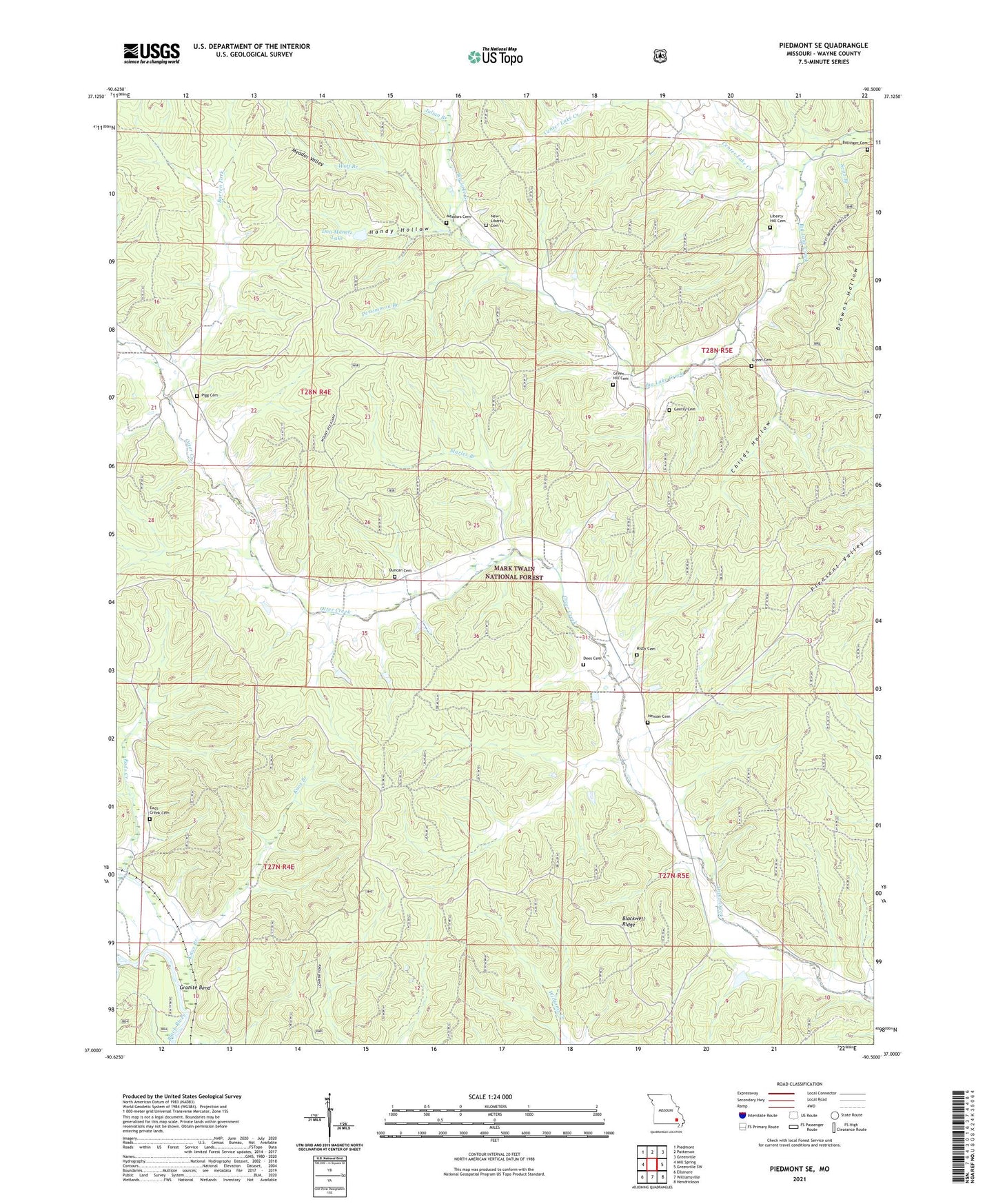
2021 topographic map quadrangle Piedmont SE in the state of Missouri. Scale: 1:24000. Based on the newly updated USGS 7.5' US Topo map series, this map is in the following counties: Wayne. The map contains contour data, water features, and other items you are used to seeing on USGS maps, but also has updated roads and other features. This is the next generation of topographic maps. Printed on high-quality waterproof paper with UV fade-resistant inks.
Quads adjacent to this one:
West: Mill Spring
Northwest: Piedmont
North: Patterson
Northeast: Greenville
East: Greenville SW
Southeast: Hendrickson
South: Williamsville
Southwest: Ellsinore
Contains the following named places: Barlow, Barren Fork, Big Lake Church, Blackwell Ridge, Bollinger Cemetery, Center Lake Creek, Childs Hollow, Dees Cemetery, Dees Chapel, Dees Chapel School, Dees Town, Don Manetz Dam, Don Manetz Lake, Duncan Cemetery, Eads Creek, Eads Creek Cemetery, Eads Creek School, Gentry Cemetery, Granite Bend, Green Cemetery, Green Hill Cemetery, Green Hill School, Handy Hollow, Henson Cemetery, Hubert, Julian Branch, Kerrigan, Knox Branch, Lake Creek School, Liberty Hill Cemetery, Liberty Hill Church, Liberty School, Marler Branch, Meador Valley, Meadors Cemetery, Mount Pleasant Church, Mount Pleasant School, New Liberty Church, Persimmon Branch, Pigg Cemetery, Pleasant Hill School, Risby Cemetery, Seitz Branch, Warrens Store, Wet Fork, Wolf Branch