MyTopo
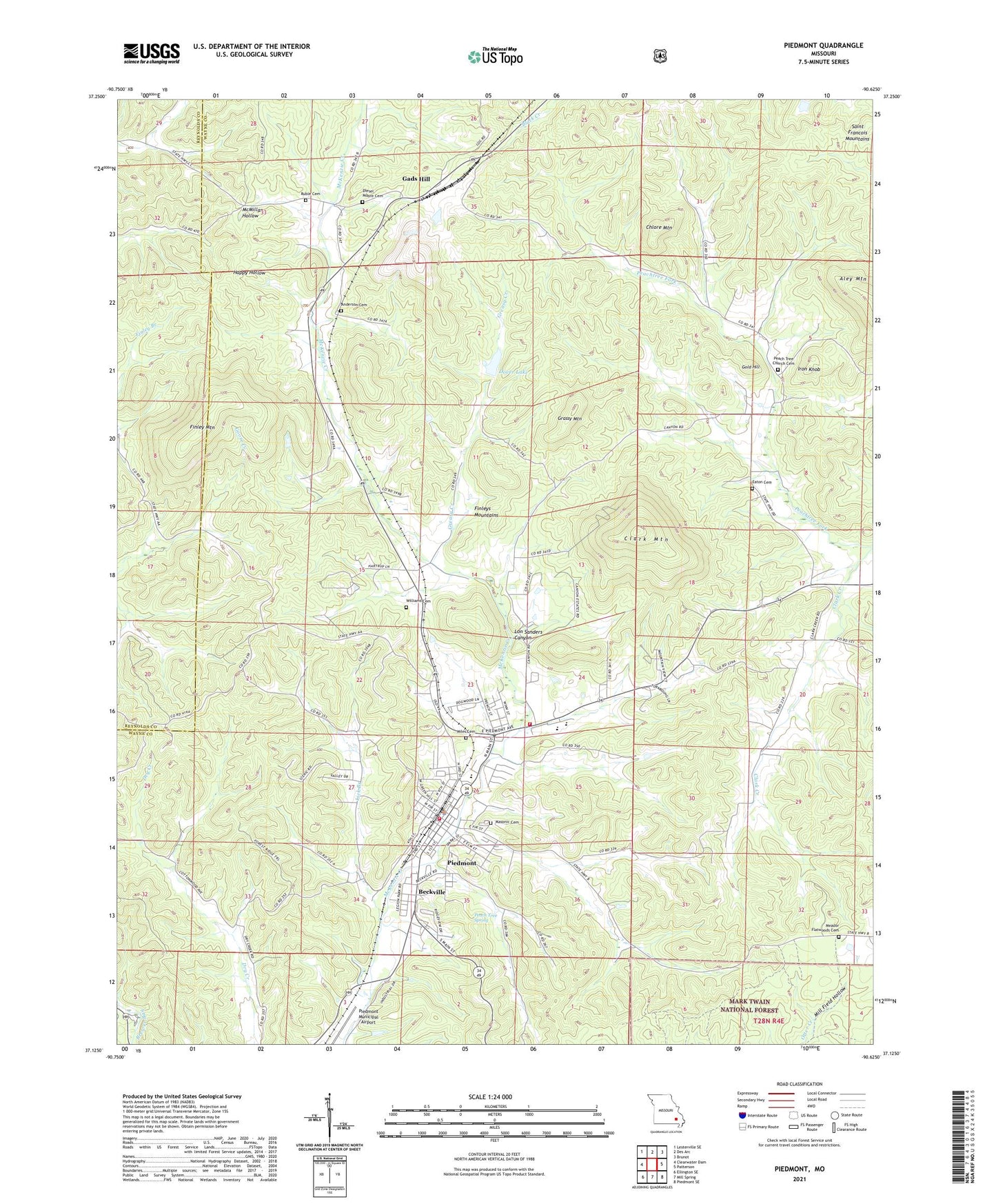
Piedmont Missouri US Topo Map
Couldn't load pickup availability
Also explore the Piedmont Forest Service Topo of this same quad for updated USFS data
2021 topographic map quadrangle Piedmont in the state of Missouri. Scale: 1:24000. Based on the newly updated USGS 7.5' US Topo map series, this map is in the following counties: Wayne, Reynolds. The map contains contour data, water features, and other items you are used to seeing on USGS maps, but also has updated roads and other features. This is the next generation of topographic maps. Printed on high-quality waterproof paper with UV fade-resistant inks.
Quads adjacent to this one:
West: Clearwater Dam
Northwest: Lesterville SE
North: Des Arc
Northeast: Brunot
East: Patterson
Southeast: Piedmont SE
South: Mill Spring
Southwest: Ellington SE
This map covers the same area as the classic USGS quad with code o37090b6.
Contains the following named places: Anderson Cemetery, Beckville, Beckville Branch, Beulah Church, Beulah School, Chlore Mountain, City of Piedmont, Clark Mountain, Clearwater Fire Protection District - Piedmont Volunteer Fire Department, Dale School, Diesel - Moore Cemetery, Dover Lake, Eaton Cemetery, Finley Mountain, Finleys Mountains, Gads Hill, Gold Hill, Grassy Creek, Grassy Mountain, Greasy Creek, Iron Knob, KPWB-AM (Piedmont), KPWB-FM (Piedmont), Lake Jeano Dam, Lebannon Church, Lick Branch, Lon Sanders Canyon, McKenzie, Missouri Department of Conservation Forestry Southeast Regional Field Fire Rescue Office Piedmont, Peach Tree Spring, Peachtree Church, Piedmont, Piedmont Police Department, Piedmont Post Office, Platow, Riverside State Forest, Rothwell Ranch Lake, Rothwell Ranch Lake Dam, Ruble Cemetery, Schmaltz, Township of Benton, Virginia Settlement, Williams Cemetery