MyTopo
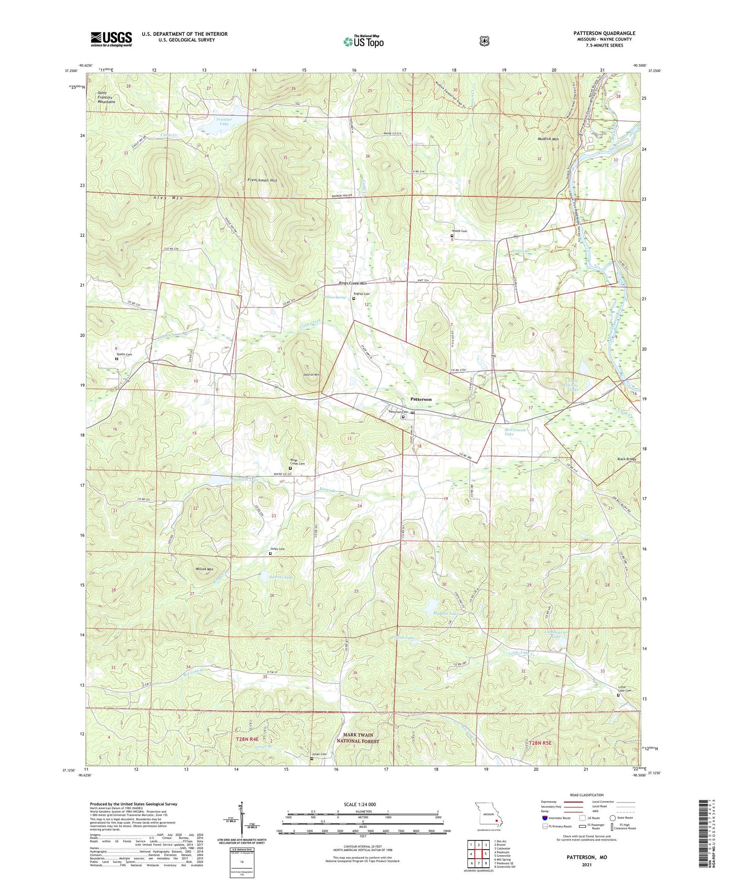
Patterson Missouri US Topo Map
Couldn't load pickup availability
Also explore the Patterson Forest Service Topo of this same quad for updated USFS data
2021 topographic map quadrangle Patterson in the state of Missouri. Scale: 1:24000. Based on the newly updated USGS 7.5' US Topo map series, this map is in the following counties: Wayne. The map contains contour data, water features, and other items you are used to seeing on USGS maps, but also has updated roads and other features. This is the next generation of topographic maps. Printed on high-quality waterproof paper with UV fade-resistant inks.
Quads adjacent to this one:
West: Piedmont
Northwest: Des Arc
North: Brunot
Northeast: Coldwater
East: Greenville
Southeast: Greenville SW
South: Piedmont SE
Southwest: Mill Spring
This map covers the same area as the classic USGS quad with code o37090b5.
Contains the following named places: A O Shearrer Lake, A O Shearrer Lake Dam, Aley Mountain, Big Creek, Black Bridge, Camp Creek, Camp Creek School, Camp Lee, Collins Lake, Collins Lake Section 31 Dam, Daffron Mountain, Damon, Damon Chapel, Damon School, English Cemetery, Frenchman Hill, Frontier Lake, Frontier Lake Dam, Fulton Spring, Hog Eye School, Jones Cemetery, Julian Cemetery, Julian Lookout Tower, Kyles, Lebanon Church, Little Hawaiis Lake, Little Hawaiis Lake Dam, Little Lake Creek Church, Logan Creek, Maddox Lake, Maddox Lake Dam, McCormick Lake, Mountain Lake, Mountain Lake Dam, Mountain View School, Neelys Mill, Patterson, Patterson Post Office, Peachtree Fork, Ring Creek School, Rings, Rings Creek, Rings Creek Cemetery, Rings Creek Church, Rings Creek Mountain, Sparks Cemetery, Sunrise Lake, Sunrise Lake Dam, Township of Logan, Wilcox Mountain, Wood School, Woods Cemetery, ZIP Code: 63956