MyTopo
Pilot Grove South Missouri US Topo Map
Couldn't load pickup availability
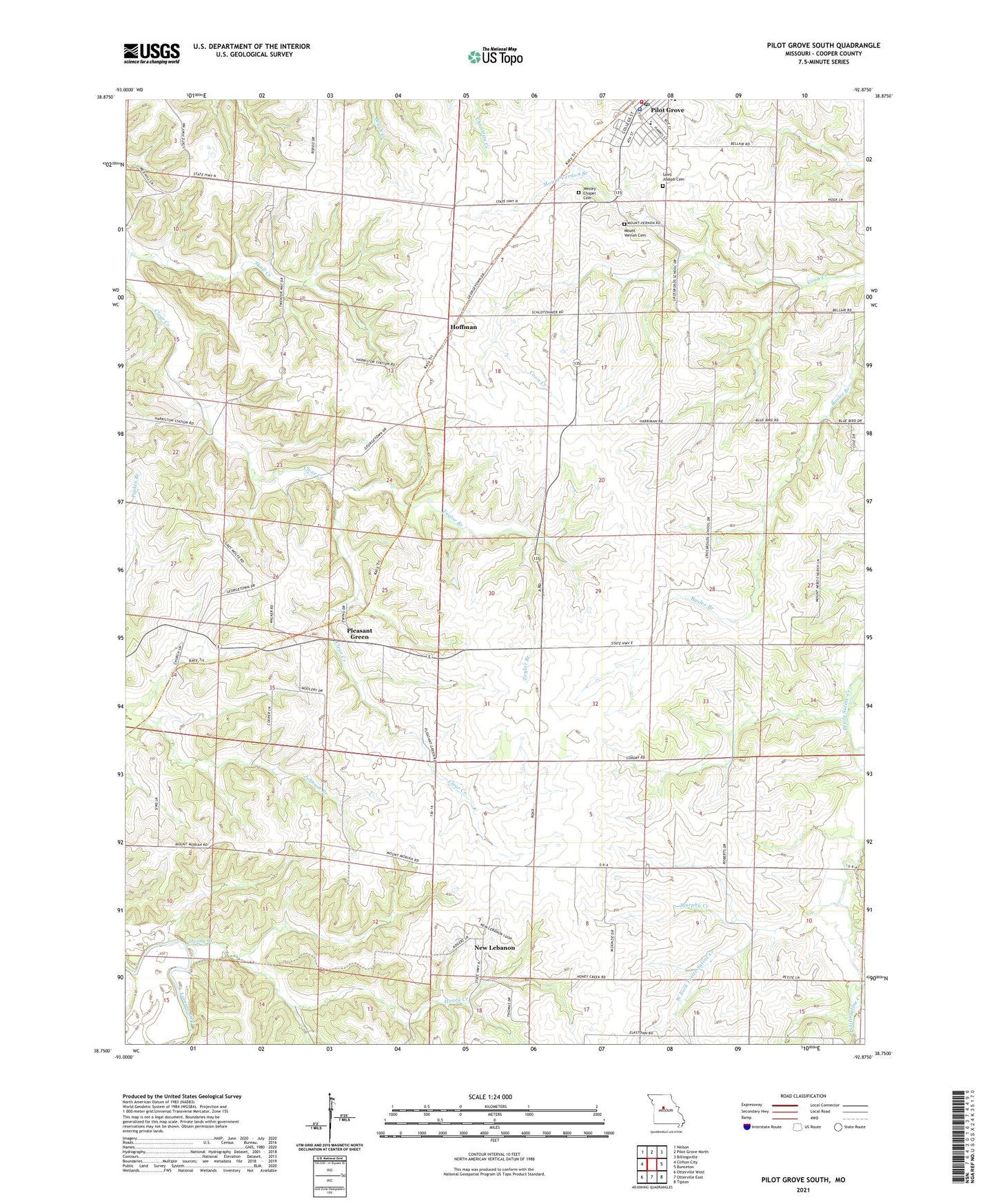
2021 topographic map quadrangle Pilot Grove South in the state of Missouri. Scale: 1:24000. Based on the newly updated USGS 7.5' US Topo map series, this map is in the following counties: Cooper. The map contains contour data, water features, and other items you are used to seeing on USGS maps, but also has updated roads and other features. This is the next generation of topographic maps. Printed on high-quality waterproof paper with UV fade-resistant inks.
Quads adjacent to this one:
West: Clifton City
Northwest: Nelson
North: Pilot Grove North
Northeast: Billingsville
East: Bunceton
Southeast: Tipton
South: Otterville East
Southwest: Otterville West
Contains the following named places: City of Pilot Grove, City of Pilot Grove Fire Department, Cotton Wood School, Harriston, Harriston School, Hoffman, Honey Creek, Lebanon School, Mount Nebo Church, Mount Nebo School, Mount Vernon Branch, Mount Vernon Cemetery, Murphy Creek, New Lebanon, Oak Hill School, Phillips Lake Dam, Pilot Grove, Pilot Grove Elementary School, Pilot Grove Fire Department, Pilot Grove Police Department, Pilot Grove Post Office, Pleasant Green, Pleasant Green Church, Pleasant Green School, Saint Johns School, Saint Joseph Cemetery, Saint Pauls Church, Skull Creek, Taylor Branch, Township of Clear Creek, Wesley Chapel, West Fork Petite Saline Creek, West Fork School, West Oakland School, ZIP Code: 65276