MyTopo
Otterville East Missouri US Topo Map
Couldn't load pickup availability
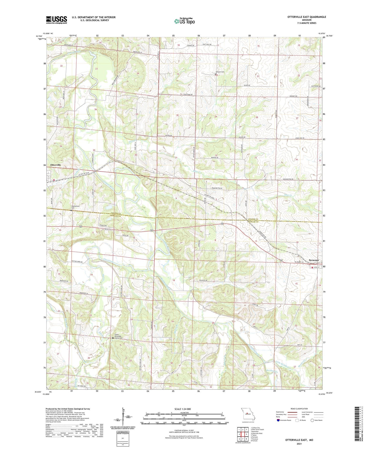
2021 topographic map quadrangle Otterville East in the state of Missouri. Scale: 1:24000. Based on the newly updated USGS 7.5' US Topo map series, this map is in the following counties: Morgan, Cooper. The map contains contour data, water features, and other items you are used to seeing on USGS maps, but also has updated roads and other features. This is the next generation of topographic maps. Printed on high-quality waterproof paper with UV fade-resistant inks.
Quads adjacent to this one:
West: Otterville West
Northwest: Clifton City
North: Pilot Grove South
Northeast: Bunceton
East: Tipton
Southeast: Fortuna
South: Florence
Southwest: Pyrmont
This map covers the same area as the classic USGS quad with code o38092f8.
Contains the following named places: Antioch Cemetery, Brushy Branch, Burford School, Byberry, Byberry School, City of Syracuse, Finley - Dinwiddie Family Cemetery, Flat Creek, Fortuna Fire Protection District Syracuse, Gabriel Creek, Harmony School, Little Richland Creek, Long Branch, McNeal Branch, Messer Creek, Mount Olive Church, Mount Olive School, Mount Zion School, Otter Creek, Otterville Fire Protection District, Richland Creek, Rockland School, Shackleford Cemetery, Soleville, Spring Branch, Township of Lebanon, Victory School, Walnut Grove Church, ZIP Code: 65348