MyTopo
Pittsville Missouri US Topo Map
Couldn't load pickup availability
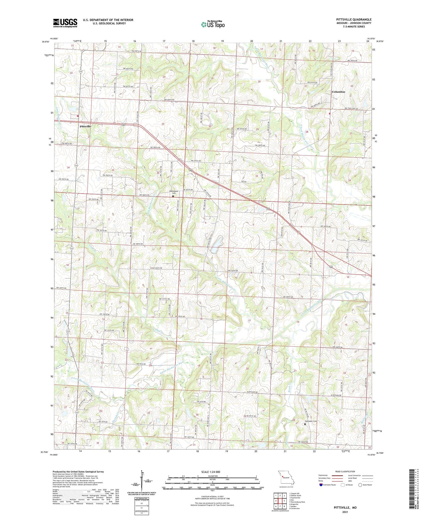
2021 topographic map quadrangle Pittsville in the state of Missouri. Scale: 1:24000. Based on the newly updated USGS 7.5' US Topo map series, this map is in the following counties: Johnson. The map contains contour data, water features, and other items you are used to seeing on USGS maps, but also has updated roads and other features. This is the next generation of topographic maps. Printed on high-quality waterproof paper with UV fade-resistant inks.
Quads adjacent to this one:
West: Elm
Northwest: Chapel Hill
North: Odessa South
Northeast: Fayetteville
East: Warrensburg West
Southeast: Centerview
South: Holden
Southwest: Kingsville
Contains the following named places: Blackwater Cemetery, Blackwater Church, Blackwater Station Church, Briar Creek, Brush Creek, Columbus, Cowan School, Cross Roads School, Dean, Dean Post Office, Douglas School, Fulkerson School, Gann Lake Dam, Grant School, Haymaker Cemetery, Heiman Lake Dam, Johnson County Fire Protection District 2 Station 2 Pittsville, Johnson County Fire Protection District Station 7 Columbus, Little Blackwater Creek, Little Creek, Miller School, Murray School, Pin Oak Creek, Pittsville, Preuss School, Roberts School, Rock Springs Bible Church, Round Grove School, Saint Johns Church, South Fork Blackwater River Watershed Dam F-2, Township of Columbus