MyTopo
Polo Missouri US Topo Map
Couldn't load pickup availability
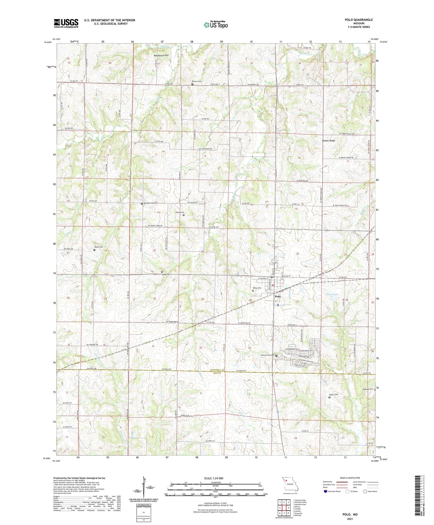
2021 topographic map quadrangle Polo in the state of Missouri. Scale: 1:24000. Based on the newly updated USGS 7.5' US Topo map series, this map is in the following counties: Caldwell, Ray. The map contains contour data, water features, and other items you are used to seeing on USGS maps, but also has updated roads and other features. This is the next generation of topographic maps. Printed on high-quality waterproof paper with UV fade-resistant inks.
Quads adjacent to this one:
West: Elmira
Northwest: Cameron East
North: Hamilton West
Northeast: Hamilton East
East: Cowgill
Southeast: Millville
South: Knoxville
Southwest: Lawson
Contains the following named places: Baker Cemetery, Brown Cemetery, Buffalo School, City of Polo, Cottonwood School, Dixon Cemetery, Dunkard Cemetery, Estes Cemetery, Hazel View School, Hicks Lake, Hicks Lake Dam, Hunt School, Hunter School, Linwood School, Log Creek Church, Lone Star School, Mayes Cemetery, McVeigh Cemetery, Nazarene Church, Needmore Hill, New Houghton School, Polo, Polo Elementary School, Polo High School, Polo Police Department, Polo Post Office, Polo Volunteer Fire and Rescue Department, Thompson School, Township of Grant, Tub Creek, Wiley Cemetery, Yankee Ridge, Yankee Ridge School, Zimmerman Cemetery, ZIP Code: 64671