MyTopo
Elmira Missouri US Topo Map
Couldn't load pickup availability
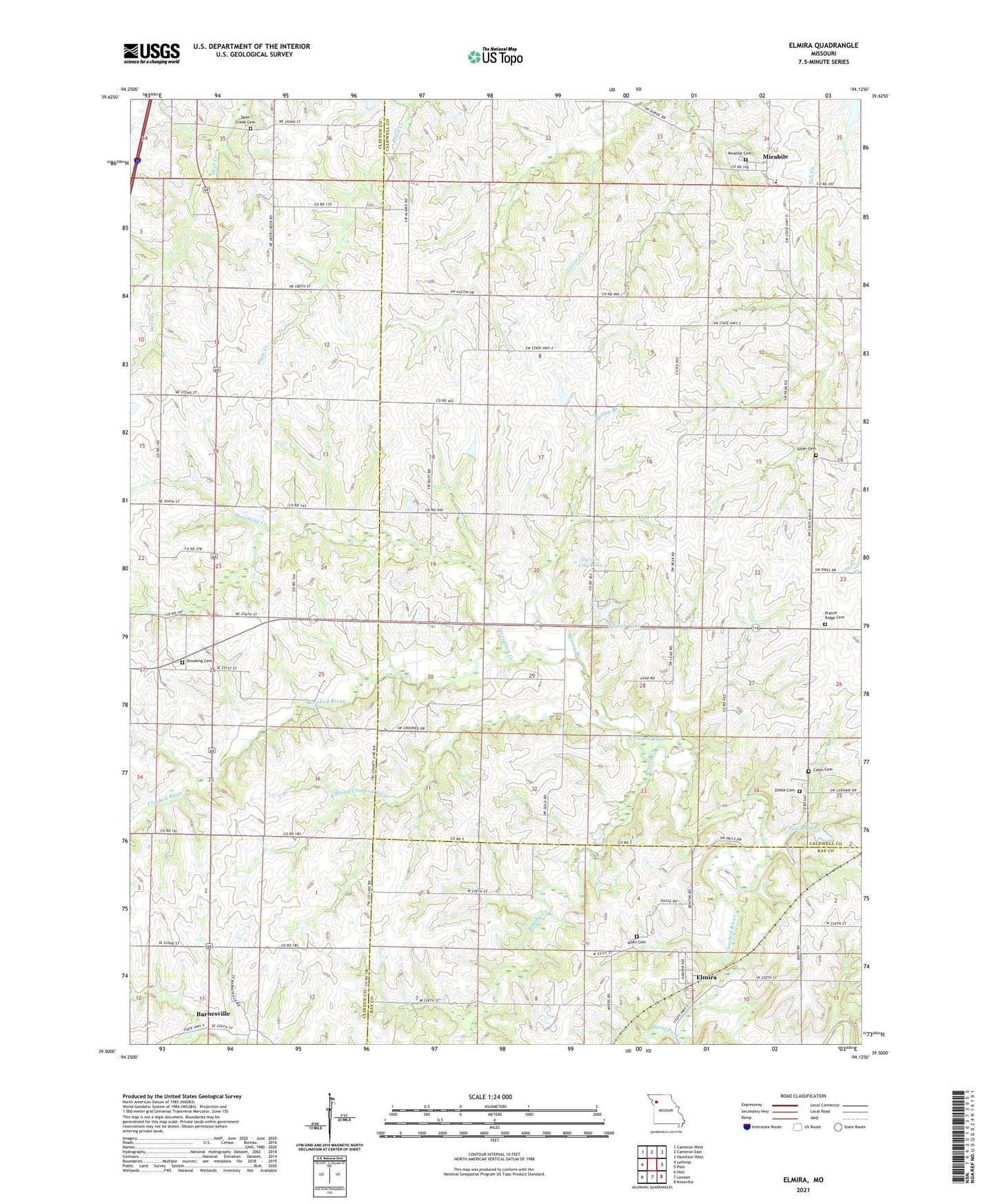
2021 topographic map quadrangle Elmira in the state of Missouri. Scale: 1:24000. Based on the newly updated USGS 7.5' US Topo map series, this map is in the following counties: Caldwell, Clinton, Ray. The map contains contour data, water features, and other items you are used to seeing on USGS maps, but also has updated roads and other features. This is the next generation of topographic maps. Printed on high-quality waterproof paper with UV fade-resistant inks.
Quads adjacent to this one:
West: Lathrop
Northwest: Cameron West
North: Cameron East
Northeast: Hamilton West
East: Polo
Southeast: Knoxville
South: Lawson
Southwest: Holt
This map covers the same area as the classic USGS quad with code o39094e2.
Contains the following named places: Allen Cemetery, Barnesville, Benton School, Brooking Cemetery, Brooking School, Brushy Creek, Burnt Fork, Cates Cemetery, Clay School, Deer Creek Cemetery, Deer Creek Union Church, Elmira, Garden City Lake, Lafayette School, Log Creek School, Martins Airport, Mayes Homestead Airport, Mirabile, Mirabile Cemetery, Mirabile Elementary School, Mound School, Pallas Lake, Pallas Lake Dam, Plainview, Plainview School, Prairie Ridge, Prairie Ridge Cemetery, Prairie Ridge School, Simmons Lake, Sloan Cemetery, South Prong Crooked River, Spring Branch, Stevenson Creek, Timber Lake, Timber Lake Dam, Township of Rockford, Village of Elmira, Zeikle Cemetery