MyTopo
Prairie Hill Missouri US Topo Map
Couldn't load pickup availability
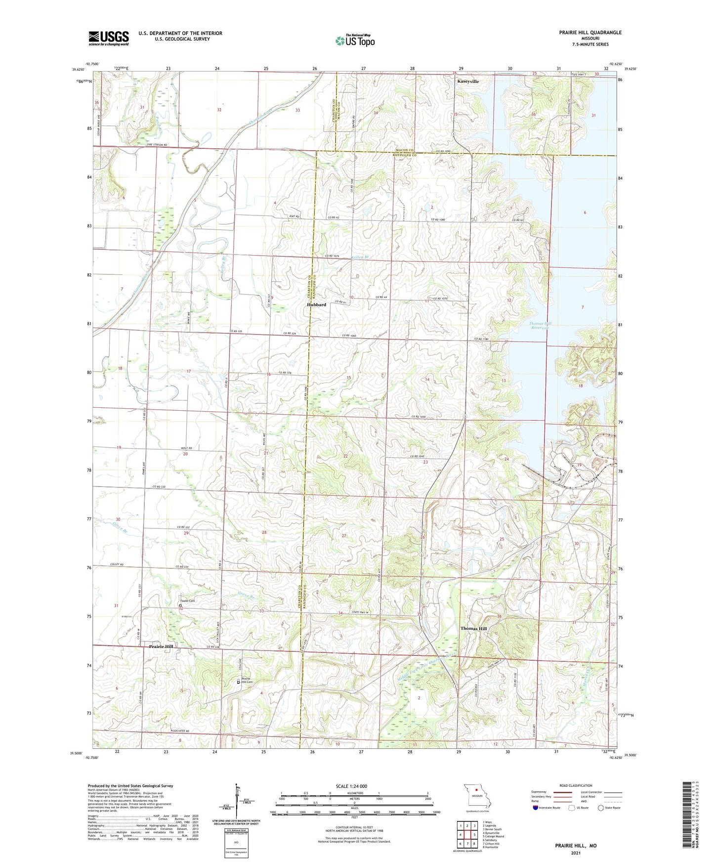
2021 topographic map quadrangle Prairie Hill in the state of Missouri. Scale: 1:24000. Based on the newly updated USGS 7.5' US Topo map series, this map is in the following counties: Randolph, Chariton, Macon. The map contains contour data, water features, and other items you are used to seeing on USGS maps, but also has updated roads and other features. This is the next generation of topographic maps. Printed on high-quality waterproof paper with UV fade-resistant inks.
Quads adjacent to this one:
West: Bynumville
Northwest: Wien
North: Lagonda
Northeast: Bevier South
East: College Mound
Southeast: Huntsville
South: Clifton Hill
Southwest: Salisbury
Contains the following named places: Barnes School, Cumberland Chapel, Fawks Cemetery, Grand Center, Hebron Church, Hubbard, Kaseyville, Kaseyville Post Office, Kelley Branch, Mount Carmel School, Prairie Hill, Prairie Hill Cemetery, Prairie Hill Census Designated Place, Puzzle Creek, Rolling Home, Rolling Home Post Office, Stinking Creek, Teter Church, Thomas Hill, Thomas Hill Reservoir, Thomas Hill Reservoir Dam