MyTopo
Republic Missouri US Topo Map
Couldn't load pickup availability
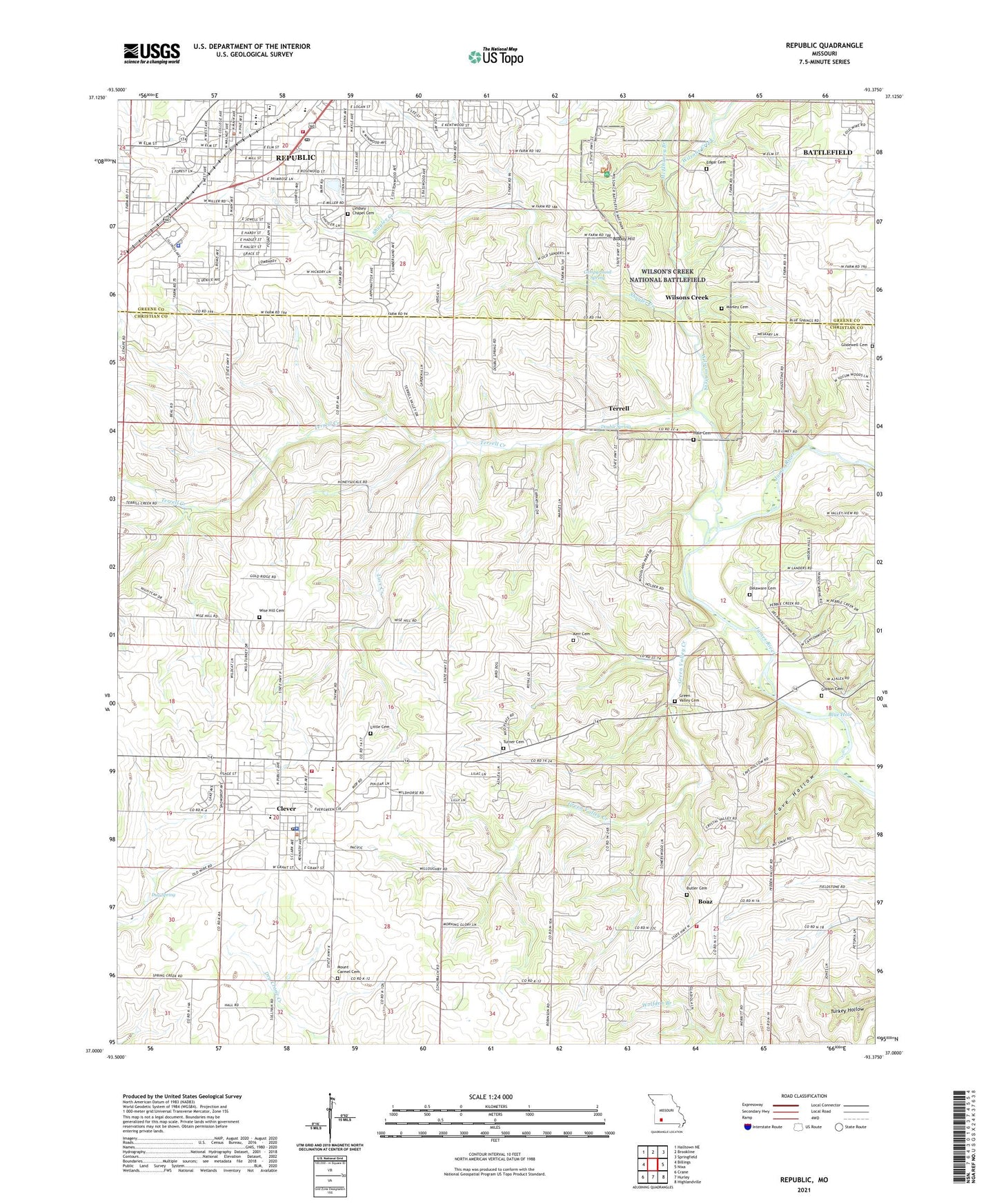
2021 topographic map quadrangle Republic in the state of Missouri. Scale: 1:24000. Based on the newly updated USGS 7.5' US Topo map series, this map is in the following counties: Christian, Greene. The map contains contour data, water features, and other items you are used to seeing on USGS maps, but also has updated roads and other features. This is the next generation of topographic maps. Printed on high-quality waterproof paper with UV fade-resistant inks.
Quads adjacent to this one:
West: Billings
Northwest: Halltown NE
North: Brookline
Northeast: Springfield
East: Nixa
Southeast: Highlandville
South: Hurley
Southwest: Crane
Contains the following named places: Bloody Hill, Blue Hole, Boaz, Butler Cemetery, Campground Spring, Capernium School, Cave Hollow, City of Clever, City of Republic, Clever, Clever Fire Protection District, Clever Fire Protection District Station 2, Clever Post Office, Clever School, Delaware Cemetery, Delaware Church, Double Spring, Du Bois Battery, Dug Spring, East Battlefield Overlook, Edgar Cemetery, Edwards Cabin, Gibson Cemetery, Gibson Mill Headrace, Gibson Oatfield, Gibson's House, Gibson's Mill, Green Valley Cemetery, Green Valley Creek, Griffin, Guibors Battery, Hale Cemetery, Kerr Cemetery, Lindsey Chapel Cemetery, Lindsey Church and School, Little Cemetery, Luce Creek, Lyon Marker, Manley Cemetery, Manley Ford, Manley Uplands Trail, McElhaney Branch, Mount Carmel Cemetery, Mount Sinai Church, Pulaski Arkansas Battery, Ray Cornfield, Ray House, Ray Orchard, Ray Springhouse, Republic, Republic Fire Department, Republic Police Department, Republic Post Office, Sharon Hill School, Sharp Farm, Shuyler Creek, Sigel's Final Position, Sigel's First Position, Sigel's Second Position, Sokalski's Section, Terrell, Terrell Creek, Totten's Battery, Township of East Republic, Township of Lincoln, Turner Cemetery, Wilsons Creek, Wilsons Creek Church, Wilson's Creek National Battlefield, Wise Hill Cemetery, Wise Hill School, ZIP Codes: 65619, 65631