MyTopo
Hurley Missouri US Topo Map
Couldn't load pickup availability
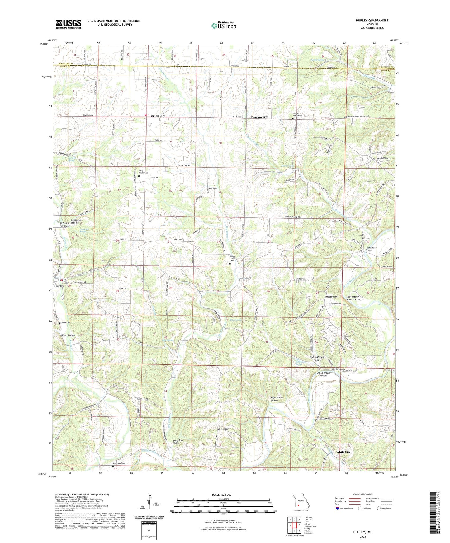
2021 topographic map quadrangle Hurley in the state of Missouri. Scale: 1:24000. Based on the newly updated USGS 7.5' US Topo map series, this map is in the following counties: Stone, Christian. The map contains contour data, water features, and other items you are used to seeing on USGS maps, but also has updated roads and other features. This is the next generation of topographic maps. Printed on high-quality waterproof paper with UV fade-resistant inks.
Quads adjacent to this one:
West: Crane
Northwest: Billings
North: Republic
Northeast: Nixa
East: Highlandville
Southeast: Spokane
South: Galena
Southwest: Elsey
This map covers the same area as the classic USGS quad with code o36093h4.
Contains the following named places: Anderson Cemetery, Barnett Spring, Bland Hollow, City of Hurley, Clever Fire Protection District Station 3, Crossroads Church, Dry Crane Creek, Goff Creek, Hampton School, Hayes Spring, Henry School, High Ridge Church, Hooten Hill, Hootentown Bridge, Hootentown Natural Arch, Hurley, Hurley Fire Station, Hurley Post Office, Inmon School, Jumbo Spring, Lane Branch, Lane Spring, Lanetown Hollow, Lanetown Spring, Little White Church, Long Tom Hollow, McCall Bridge, McCullah Hollow, Molly Wright Cemetery, Old Stillhouse Hollow, Old Stillhouse Spring, Oto Ridge, Possum Trot, Richmond School, Sam Thomas Camp, School, Short Cemetery, Silver Lake, Silver Lake Branch, Smith Brown Hollow, Spring Creek, Sugar Camp Hollow, Township of Cass, Township of Hurley, Township of Union, Union City, Union Ridge Church, White Cemetery, White City, Wright Chapel, Wright Chapel Cemetery