MyTopo
Roads Missouri US Topo Map
Couldn't load pickup availability
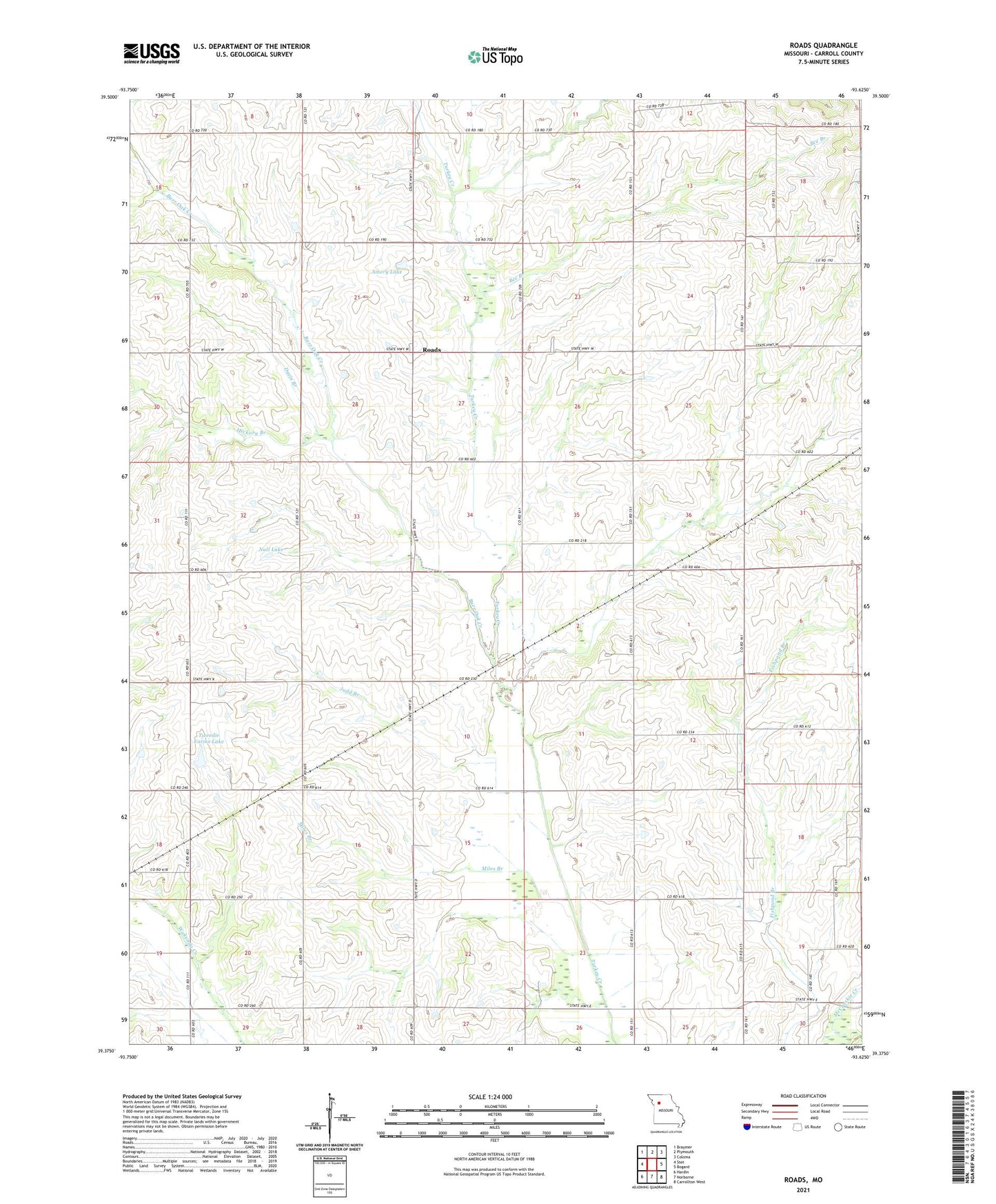
2021 topographic map quadrangle Roads in the state of Missouri. Scale: 1:24000. Based on the newly updated USGS 7.5' US Topo map series, this map is in the following counties: Carroll. The map contains contour data, water features, and other items you are used to seeing on USGS maps, but also has updated roads and other features. This is the next generation of topographic maps. Printed on high-quality waterproof paper with UV fade-resistant inks.
Quads adjacent to this one:
West: Stet
Northwest: Braymer
North: Plymouth
Northeast: Coloma
East: Bogard
Southeast: Carrollton West
South: Norborne
Southwest: Hardin
Contains the following named places: Amery Lake, Amery Lake Dam, Antioch Church, Bee Branch, Burr Oak Creek, Davis Branch, Enterprise School, Hawkins Airport, Hickory Branch, Judd, Judd Branch, Judd School, Lost Branch, Miles Branch, Mount Carmel Church, Mount Olive Church, Null Lake, Null Lake Dam, Prairie Dell School, Roads, Roads School, Stamm School, Township of Fairfield, Township of Prairie, Tweedie Farms Lake, Tweedie Farms Lake Dam, Union Church