MyTopo
Coloma Missouri US Topo Map
Couldn't load pickup availability
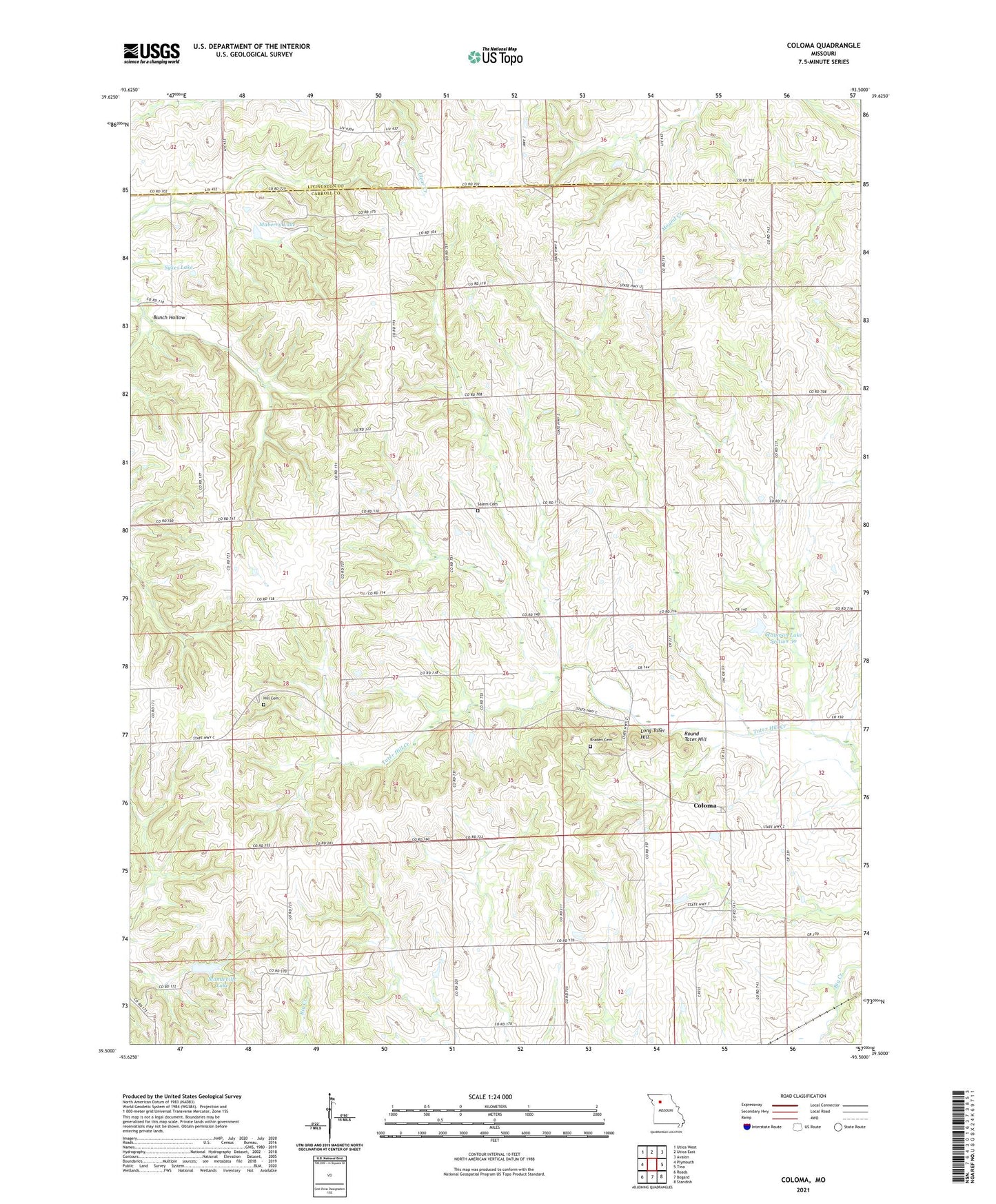
2021 topographic map quadrangle Coloma in the state of Missouri. Scale: 1:24000. Based on the newly updated USGS 7.5' US Topo map series, this map is in the following counties: Carroll, Livingston. The map contains contour data, water features, and other items you are used to seeing on USGS maps, but also has updated roads and other features. This is the next generation of topographic maps. Printed on high-quality waterproof paper with UV fade-resistant inks.
Quads adjacent to this one:
West: Plymouth
Northwest: Utica West
North: Utica East
Northeast: Avalon
East: Tina
Southeast: Standish
South: Bogard
Southwest: Roads
This map covers the same area as the classic USGS quad with code o39093e5.
Contains the following named places: Braden Cemetery, Braden School, Bunch Hollow, Coloma, Coloma School, Cream Ridge School, Fisher, Fisher Post Office, Franklin School, Greenwood School, Harts Lake, Harts Lake Dam, Henry Lake, Henry Lake Dam, Hill Cemetery, Isom School, Locust School, Long Tater Hill, Maberry Lake, Maberry Lake Dam, Mandeville Lake, Mandeville Lake Dam, Maple Grove School, New Salem Church, Oak Hill School, Round Tater Hill, Rush Chapel, Salem Cemetery, School Number 7, Stagner School, Susewine Lake, Susewine Lake Dam, Sykes Lake, Sykes Lake Dam, Township of Hill, Waitman Lake Section 30, Waitman Lake Section 30 Dam, Wooden School, ZIP Code: 64638