MyTopo
Bogard Missouri US Topo Map
Couldn't load pickup availability
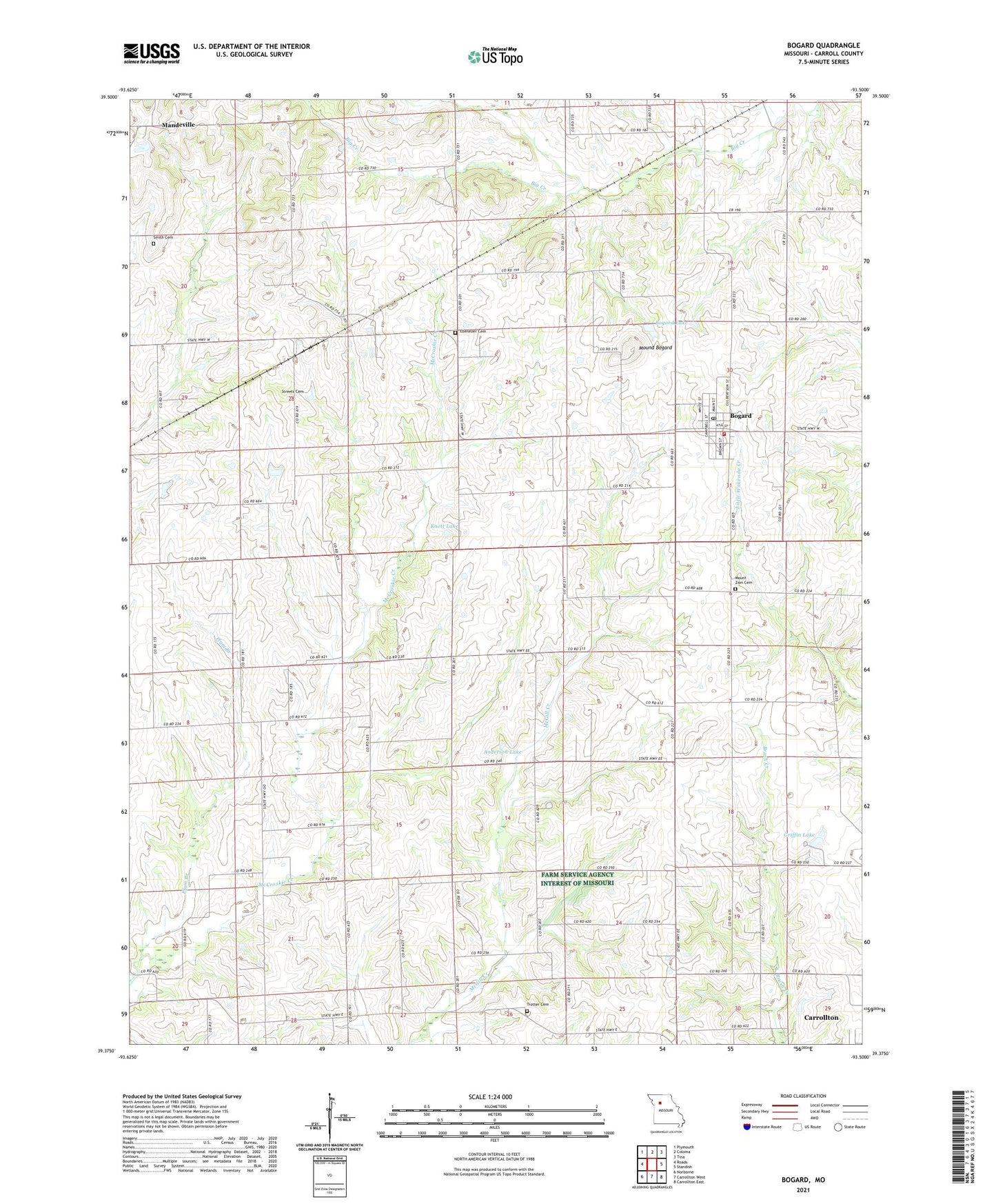
2021 topographic map quadrangle Bogard in the state of Missouri. Scale: 1:24000. Based on the newly updated USGS 7.5' US Topo map series, this map is in the following counties: Carroll. The map contains contour data, water features, and other items you are used to seeing on USGS maps, but also has updated roads and other features. This is the next generation of topographic maps. Printed on high-quality waterproof paper with UV fade-resistant inks.
Quads adjacent to this one:
West: Roads
Northwest: Plymouth
North: Coloma
Northeast: Tina
East: Standish
Southeast: Carrollton East
South: Carrollton West
Southwest: Norborne
This map covers the same area as the classic USGS quad with code o39093d5.
Contains the following named places: Aalberg Siding, Anderson Lake, Anderson Lake Dam, Austin School, Bingham, Bingham School, Bogard, Bogard Lake, Bogard Post Office, Brown School, Carroll County, Church of Christ, City of Bogard, Ebenezer Cemetery, Germann Lake Dam, Griffin Lake, Griffin Lake Dam, Hartis School, Hood School, Jarvis Lake, Jarvis Lake Dam, Knott Lake, Knott Lake Dam, Mandeville, Mandeville School, McCroskie Church, Mound Bogard, Mount Zion Cemetery, North Central Carroll Fire Protection District Bogard Fire Department, Plum Branch, Powell School, Reynolds School, Smith Cemetery, Star School, Streets Cemetery, Township of Leslie, Township of Trotter, Trotter Cemetery, Trotter School, ZIP Code: 64622