MyTopo
Saint Clair Missouri US Topo Map
Couldn't load pickup availability
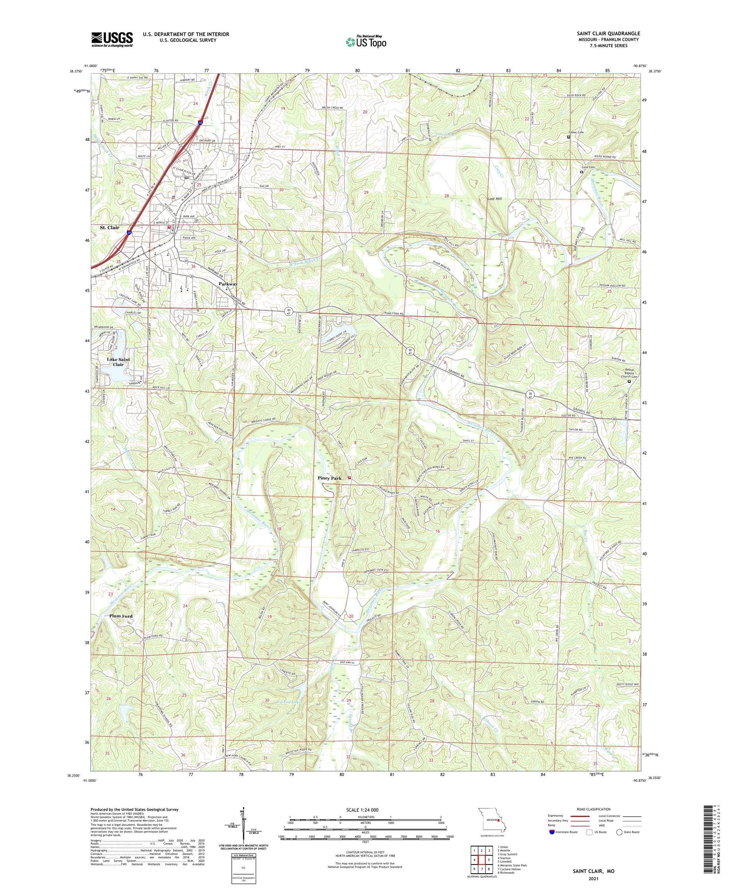
2021 topographic map quadrangle Saint Clair in the state of Missouri. Scale: 1:24000. Based on the newly updated USGS 7.5' US Topo map series, this map is in the following counties: Franklin. The map contains contour data, water features, and other items you are used to seeing on USGS maps, but also has updated roads and other features. This is the next generation of topographic maps. Printed on high-quality waterproof paper with UV fade-resistant inks.
Quads adjacent to this one:
West: Stanton
Northwest: Union
North: Moselle
Northeast: Gray Summit
East: Lonedell
Southeast: Richwoods
South: Cyclone Hollow
Southwest: Meramec State Park
Contains the following named places: Bethel Baptist Church Cemetery, Bethel Church, Brush Creek, Brush Creek School, Carved Lake, Carved Lake Dam, City of Saint Clair, Cove Cemetery, Cove Church, Cove Creek, Cove School, Cove Spring, Crescent Lake Dam, Duenler School, Fairview School, Fisher Cemetery, Gibson Creek, Girard Branch, Heil Lake Dam, Hoosier Creek, Indian Creek, Lake Saint Clair, Lake Saint Clair Census Designated Place, Lake Saint Clair Number One Dam, Lake Saint Clair Number Two Dam, Lake Thunderbird Dam, Lost Hill, Mount Hope School, Oklahoma School, Parkway, Peters Lake Dam, Pine Bluff School, Piney Park, Plum Ford, Pond Ford, Rohls Ford, Rye Creek, Rye Creek School, Saint Clair, Saint Clair Fire Protection District Station 1, Saint Clair Fire Protection District Station 3, Saint Clair Police Department, Saint Clair Post Office, Smith Lake Dam, St Clair Regional Airport, Township of Central, Village of Parkway, Virginia Lead Mines Ford, Virginia Mines, Virginia Mines Church, West Fork Brush Creek, ZIP Codes: 63060, 63077