MyTopo
Summersville NE Missouri US Topo Map
Couldn't load pickup availability
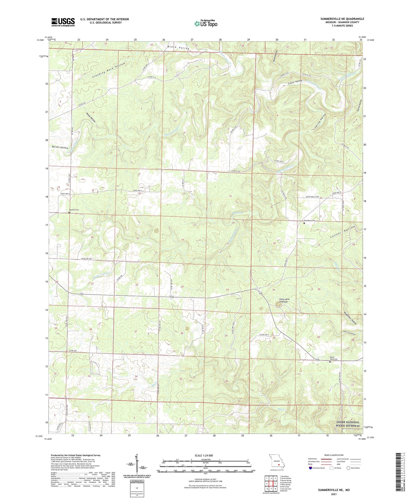
2021 topographic map quadrangle Summersville NE in the state of Missouri. Scale: 1:24000. Based on the newly updated USGS 7.5' US Topo map series, this map is in the following counties: Shannon. The map contains contour data, water features, and other items you are used to seeing on USGS maps, but also has updated roads and other features. This is the next generation of topographic maps. Printed on high-quality waterproof paper with UV fade-resistant inks.
Quads adjacent to this one:
West: Summersville
Northwest: Hartshorn
North: Lewis Hollow
Northeast: Round Spring
East: Alley Spring
Southeast: Bartlett
South: Jam Up Cave
Southwest: Pine Crest
Contains the following named places: Barnes Hollow, Black Pond Cemetery, Black Pond School, Black Valley, Black Valley Creek, Casto Valley, Casto Valley Creek, Cave Spring, Flat Rock Church, Flat Rock School, Flat Rock State Wildlife Area, Forty Acre Sinkhole, Hawk Hollow, Helms School, Randolph School, Rock Lookout Tower, Township of Spring Valley, Wildwood School, Wolf Hollow, ZIP Code: 65571