MyTopo
Summersville Missouri US Topo Map
Couldn't load pickup availability
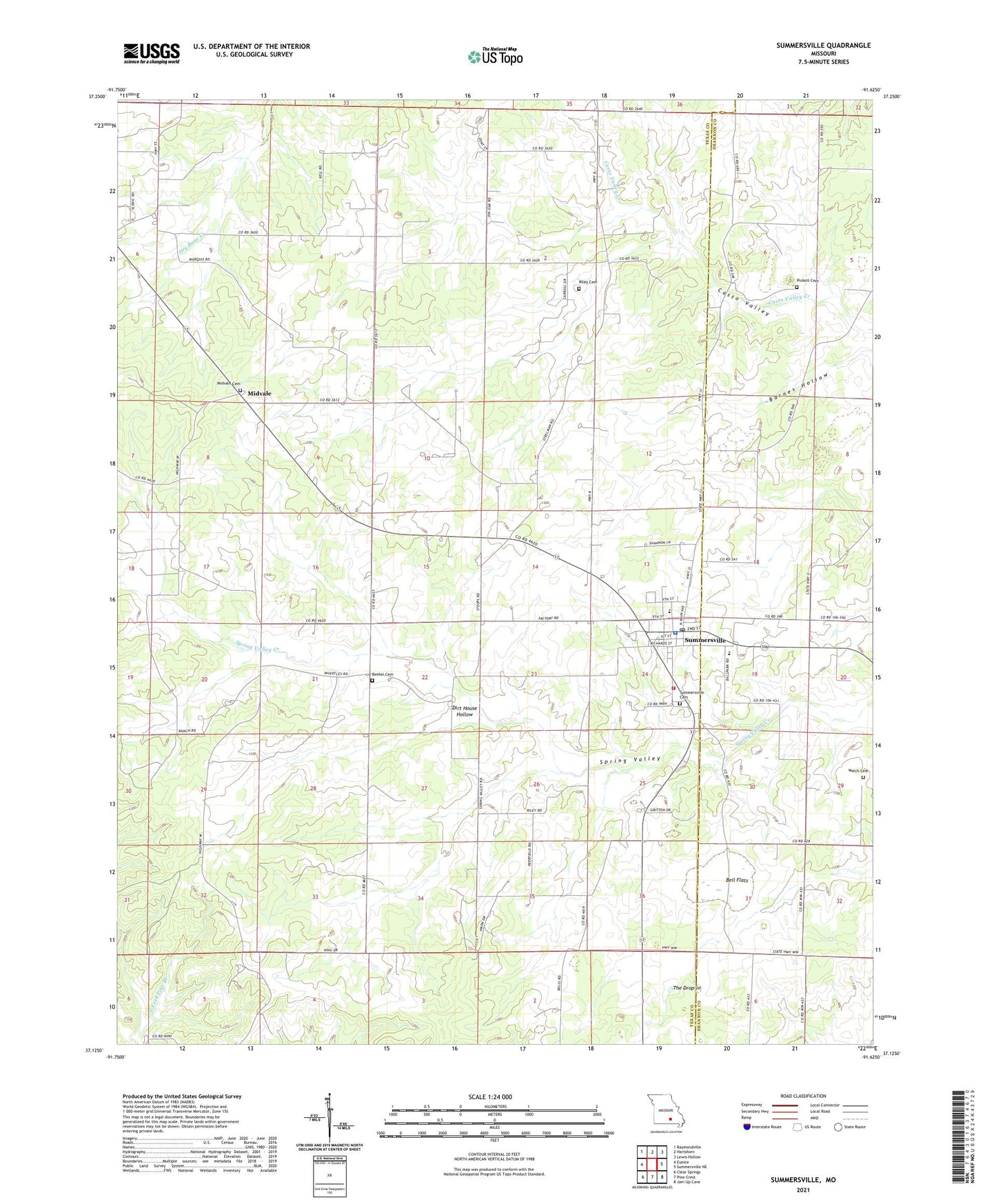
2021 topographic map quadrangle Summersville in the state of Missouri. Scale: 1:24000. Based on the newly updated USGS 7.5' US Topo map series, this map is in the following counties: Texas, Shannon. The map contains contour data, water features, and other items you are used to seeing on USGS maps, but also has updated roads and other features. This is the next generation of topographic maps. Printed on high-quality waterproof paper with UV fade-resistant inks.
Quads adjacent to this one:
West: Eunice
Northwest: Raymondville
North: Hartshorn
Northeast: Lewis Hollow
East: Summersville NE
Southeast: Jam Up Cave
South: Pine Crest
Southwest: Clear Springs
Contains the following named places: Bell Flats, Bethel Church, City of Summersville, Dirt House Hollow, Griffith School, Johns School, Kell School, Laidley School, Leidy School, Midvale, Midvale Church, Oak Hill School, Oak Ridge School, Pickett Cemetery, Riley Cemetery, Riley School, Summersville, Summersville Cemetery, Summersville Fire and Rescue, Summersville Fire Tower, Summersville Police Department, Summersville Post Office, The Drop-in, Township of Carroll, Welch School