MyTopo
Clear Springs Missouri US Topo Map
Couldn't load pickup availability
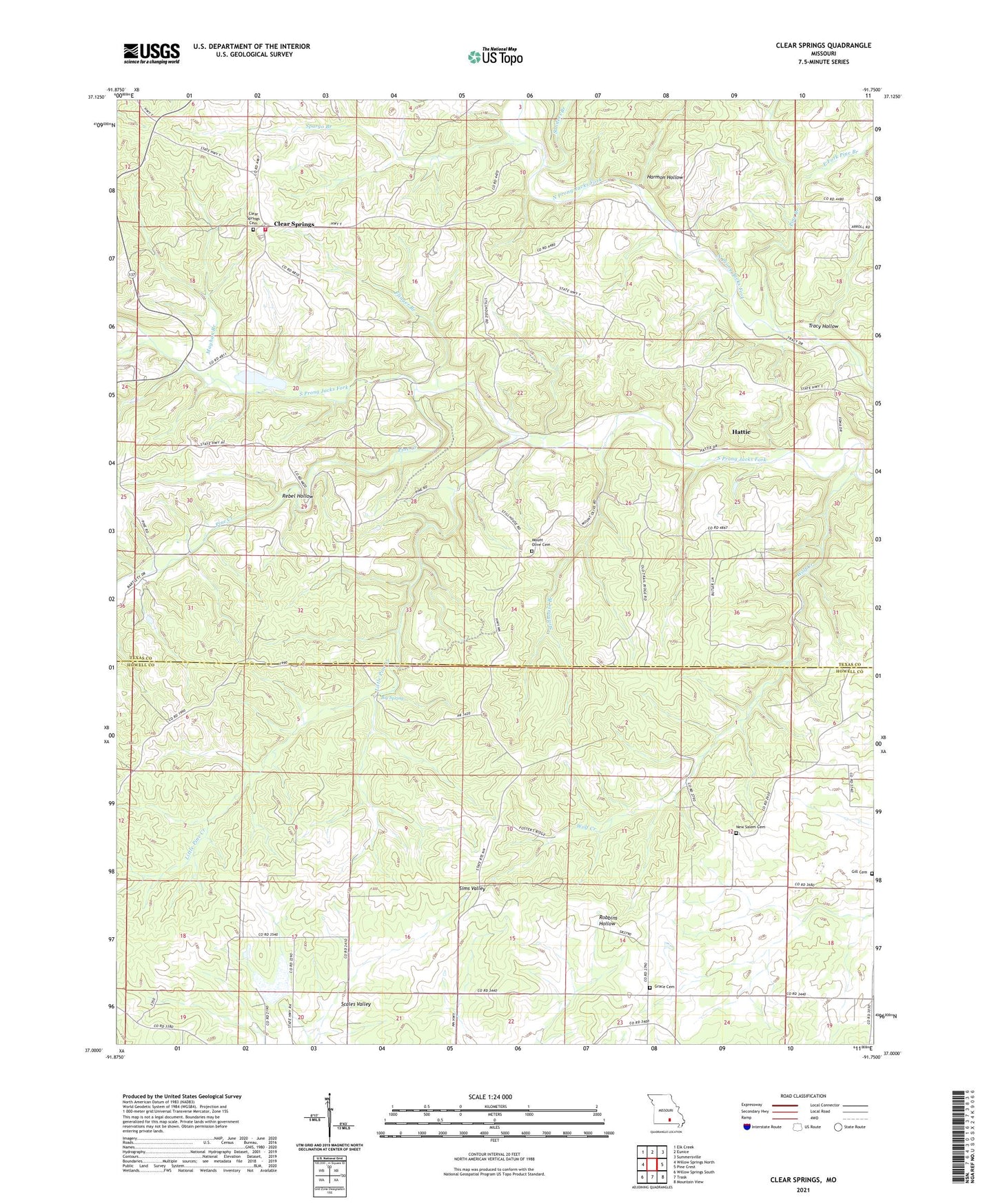
2021 topographic map quadrangle Clear Springs in the state of Missouri. Scale: 1:24000. Based on the newly updated USGS 7.5' US Topo map series, this map is in the following counties: Texas, Howell. The map contains contour data, water features, and other items you are used to seeing on USGS maps, but also has updated roads and other features. This is the next generation of topographic maps. Printed on high-quality waterproof paper with UV fade-resistant inks.
Quads adjacent to this one:
West: Willow Springs North
Northwest: Elk Creek
North: Eunice
Northeast: Summersville
East: Pine Crest
Southeast: Mountain View
South: Trask
Southwest: Willow Springs South
This map covers the same area as the classic USGS quad with code o37091a7.
Contains the following named places: Big Spring, Big Spring Creek, Clear Springs, Clear Springs Rural Fire Protection Association, Clear Springs School, East Fork Pine Branch, Flinger Branch, Gill Cemetery, Grace Church, Guild, Harmon Hollow, Hattie, Hattie Post Office, Houston School, Little Pine Creek, Mayhan Branch, Mount Olive Church, Mount Olive School, New Salem Cemetery, New Salem Church, Oak Ridge School, Pine Branch, Pine Creek, Rebel Hollow, Rocky Mountain Ranch, Sanders Branch, Scales Valley, Shuld Branch, Sims Valley Community Lake Dam, Sims Valley State Community Lake, Solid Rock Church, Spargo Branch, Stillhouse Branch, Township of Pierce, Tracy Hollow, Vaughn School, Wofford School, Wolf Creek