
MyTopo
Theodosia Missouri US Topo Map
Couldn't load pickup availability
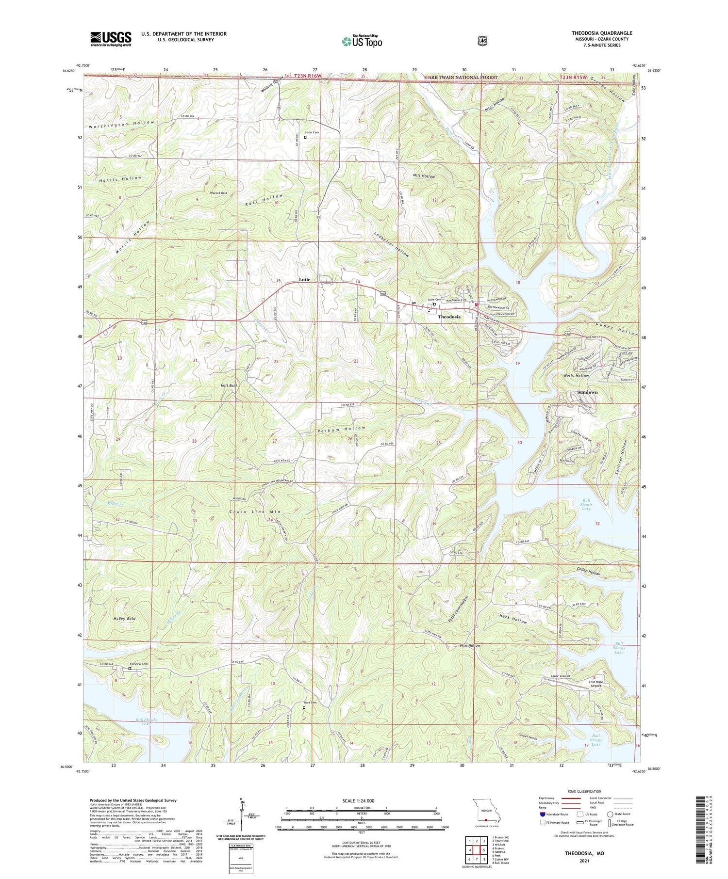
2021 topographic map quadrangle Theodosia in the state of Missouri. Scale: 1:24000. Based on the newly updated USGS 7.5' US Topo map series, this map is in the following counties: Ozark. The map contains contour data, water features, and other items you are used to seeing on USGS maps, but also has updated roads and other features. This is the next generation of topographic maps. Printed on high-quality waterproof paper with UV fade-resistant inks.
Quads adjacent to this one:
West: Protem
Northwest: Protem NE
North: Thornfield
Northeast: Willhoit
East: Isabella
Southeast: Bull Shoals
South: Cotter NW
Southwest: Peel
Contains the following named places: Barefoot School, Briar Hollow, Chain Link Mountain, Coilep Hollow, Cole Hollow, Cowpen Hollow, Dugginsville, Dugginsville School, Fairview Cemetery, Fairview School, Friend Cemetery, Greene Hollow, Guber Hollow, Hart Cemetery, Heck Hollow, Hicks Cemetery, Holt Bald, Ledbetter Hollow, Long Run Volunteer Fire Department, Lost Mine Airport, Lutie, Lutie Cemetery, Lutie School, McVey Bald, McVey Branch, Mill Hollow, Miller Creek, Mud Point School, Neasby Ford, Ocie Volunteer Fire Department, Peacock Bald, Pelham Hollow, Peter Cave Hollow, Pond Fork, Rail Hollow, Salem School, Shiloh Church, Shiloh School, Squirrel Hollow, Stony Point School, Sundown, Sundown Census Designated Place, Theodosia, Theodosia Hills Landing strip, Theodosia School, Theodosia Volunteer Fire Department, Township of Big Creek, True Hope Church, Turkey Creek, Village of Theodosia, Wells Hollow, ZIP Code: 65761


