MyTopo
Bull Shoals Arkansas US Topo Map
Couldn't load pickup availability
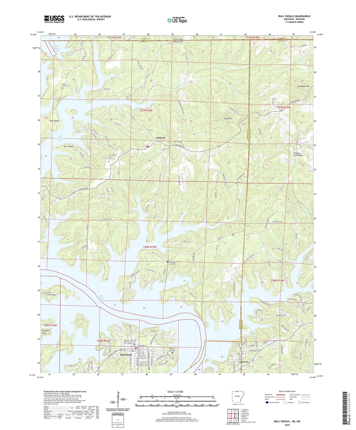
2024 topographic map quadrangle Bull Shoals in the state of Arkansas. Scale: 1:24000. Based on the newly updated USGS 7.5' US Topo map series, this map is in the following counties: Marion, Baxter, Ozark. The map contains contour data, water features, and other items you are used to seeing on USGS maps, but also has updated roads and other features. This is the next generation of topographic maps. Printed on high-quality waterproof paper with UV fade-resistant inks.
Quads adjacent to this one:
West: Cotter NW
Northwest: Theodosia
North: Isabella
Northeast: Gainesville
East: Midway
Southeast: Mountain Home West
South: Cotter
Southwest: Cotter SW
Contains the following named places: Bull Hollow, Bull Shoals, Bull Shoals Police Department, Bull Shoals Post Office, Bull Shoals Public Use Area, Bull Shoals Shopping Center, Bull Shoals Volunteer Fire Department, Christ by the Lake Lutheran Church, Dry Run, Grover Township Volunteer Fire Department, Gunnel Fork, Hilltop Mission, Horseshoe Mountain, Howard Creek, Lakeview Public Use Area, Long Mountain, Mountain Creek, Newton Flat Cemetery, Noe Creek, Oak Hollow, Oakland, Oakland - Promise Land Volunteer Fire Department Station 1, Oakland Census Designated Place, Oakland Post Office, Oakland Promise Land Volunteer Fire Department Station 2, Oakland School, Pace Ferry, Point Return Public Use Area, Price Church, Price Place, Price Place Cemetery, Price Place School, Promise Land Church, Promise Land Ridge, Promised Land Cemetery, Sister Creek, Strawberry Creek, Township of Grover, Township of North Fork, Wolf Creek, ZIP Codes: 72642, 72661