MyTopo
Vandalia Missouri US Topo Map
Couldn't load pickup availability
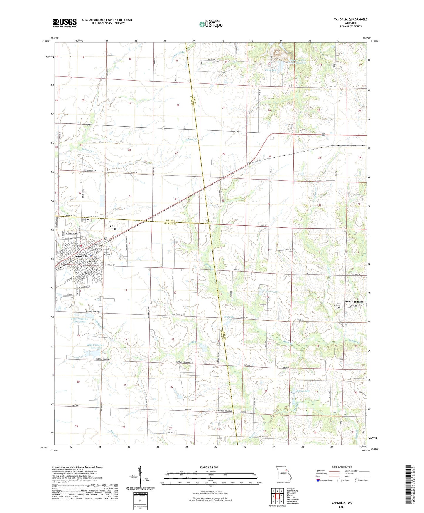
2021 topographic map quadrangle Vandalia in the state of Missouri. Scale: 1:24000. Based on the newly updated USGS 7.5' US Topo map series, this map is in the following counties: Pike, Audrain, Ralls. The map contains contour data, water features, and other items you are used to seeing on USGS maps, but also has updated roads and other features. This is the next generation of topographic maps. Printed on high-quality waterproof paper with UV fade-resistant inks.
Quads adjacent to this one:
West: Farber
Northwest: Perry NE
North: Spencerburg
Northeast: Frankford
East: Curryville
Southeast: New Hartford
South: Middletown
Southwest: Vandalia Lake
Contains the following named places: Airpark Private Airport, Boyd School, Brush Branch, City of Vandalia, Community Church, Daniels Park, Elm Grove Church, Elm Grove School, Eureka School, Goodpasture Airstrip, Harris Lake, Harris Lake Dam, Haw Creek, KLRK-FM (Vandalia), Kohl Irrigation Lake North, Kohl Irrigation Lake North Dam, Kohl Irrigation Lake South, Kohl Irrigation Lake South Dam, Kohl Lake East, Kohl Lake East Dam, Kohl Lake West, Kohl Lake West Dam, Liberty School, Lincoln School, Missouri Department of Corrections Women's Eastern Reception Diagnostic and Correctional Center, Morris Dam, Morris Lake, New Harmony Cemetery, New Michigan School, North School, Prairie Lane School, Prairie View School, Round Grove School, Shattuck School, South School, Spring Dale, Springdale Post Office, Stone Lake, Talbert Lake Dam, Vandalia, Vandalia Cemetery, Vandalia Country Club, Vandalia Police Department, Vandalia Post Office, Vandalia Rural Fire and Rescue, W L Morris Dam, ZIP Code: 63382